Dedicated geostatistics based library for reliable dose rate mapping in a mouse click
ISYmap is a French start-up that launched GLOBall (GeoLOcalized Ball) early 2016, a revolutionary system allowing remoted and fast dose rate measurement and mapping, easy and quick to set up by operators staying far from hazard area in safe conditions. ISYmap has integrated QuickMap, a dedicated geostatistics-based library developed by Geovariances for a reliable mapping process.
The challenge
The GLOBall system consists in a set of autonomous and connected balls embedding sensors that can be dropped over contaminated areas thanks to their shockproof characteristics. Balls periodically measure the dose rate level at the positions where they have landed. They communicate with a software application which collects and stores data for mapping purposes.
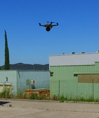
The challenge for ISYmap was to conceive a solution allowing, firstly, to make measurements in unsafety areas while protecting operators, secondly, to quickly produce a map in a maximum of two clicks while ensuring its reliability and realism.
Convinced that kriging was the right interpolation method to use, they were looking for a well-tried and proven software solution offering geostatistical algorithms. But no off-the-shelf software package could answer their requirements for a two-click solution.
The solution
ISYmap called on Geovariances for the development of a geostatistical library to be embedded in their software application. QuickMap was developed to answers ISYmap specific requirements and integrated in GLOBall¹.
The results
Quick, easy and reliable mapping
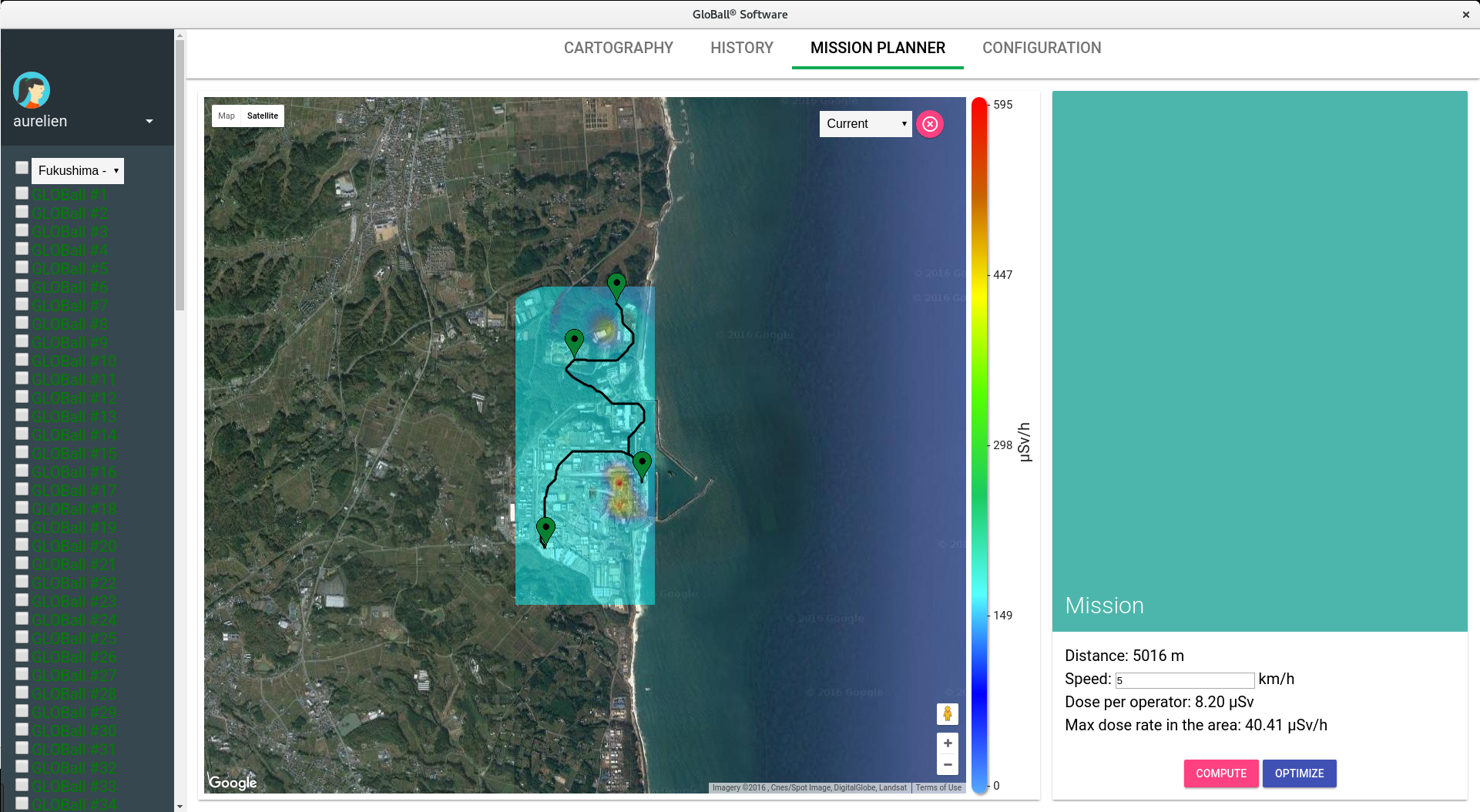
“2 minutes are more than enough to produce a map from collected data.”, ISYmap managing director Aurélien Ballier says.
The QuickMap library embeds Geovariances know-how in geostatistics, and particularly its powerful algorithm for automatic variogram fitting, a critical step in geostatistics processing.
The interpolated map is associated to its uncertainty map allowing operators to identify under sampled areas.
Safer routes for operators

From the interpolated map, GLOBall then calculates optimized routes that limit operator dose exposure and the associated global mission time. These routes, if not convenient, can be corrected manually.
The perspectives
This is not the end of it. ISYMap and Geovariances are still collaborating to improve the GLOBall system.
¹ GLOBall by ISYmap is a global offer including one set of balls and a drone, electronics and software application, together with Kartotrak.one for data post-processing. Kartotrak.one is a light version of Kartotrak, Geovariances integrated software solution for contaminated site characterization.