Proof of Concept has demonstrated that Kartotrak can provide key information to a project manager for better risk management.

After several technical exchanges between NUVIA Process and Geovariances about the use of geostatistics for radiologically contaminated soil characterization, a guided evaluation was conducted to try Kartotrak on a real dataset.
The first objective was to ensure that the resulting data was compatible with NUVIA Process georeferenced equipments before running Kartotrak workflow.
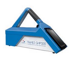
Indeed, NUVIA Process develops innovating investigation equipments to map radiological contaminations especially with the vehicle NuHLS GHP 1000 and the portable device NuHLS GHV 100.
Kartotrak guided evaluation enabled:
- to interactively georeference different base maps;
- to compare several sampling campaign;
- to validate data;
- to analyse spatial structures and produce reliable estimation and risks analysis maps (detection of under -or- over sampled zones or of strong variability zones, comparison with background level).
Bruno FERET, Manager of the Nuclear Measurement Department, said: “This report is very interesting and demonstrates that we can go way further than just placing points on a map.
Kartotrak produces uncertainty maps, risk maps of exceeding specified contamination thresholds and representation of the contaminated land surfaces according to the risk of leaving a pollution on site, which provide key information to a project manager.”
Following this first joint evaluation, NUVIA Process has decided to train a member of their team on Kartotrak. Several ideas and possible future collaborations will emerge from the NUVIA Process and Geovariances respective expertises.