 |
| |
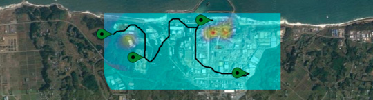
| Protect your employees thanks to geostatistics |
|
Geostatistics enables to quickly deliver reliable dose rate maps. It is particularly relevant for those who need to know what contamination level people may be exposed to, both outside and inside buildings.
ISYmap has integrated QuickMap, a dedicated geostatistics-based library developed by Geovariances, for a reliable mapping process.
|
| |
|
|
| |
 |
| |
| Geolocalize images with Kartotrak |
|
Because sometimes you need to enrich your displays with information only available on paper maps, Kartotrak offers interactive tools to help you georeferencing images. Just in a few clicks, the software lets you fit any image to the scene...
|
| |
|
|
| |
 |
| |
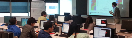
| Ask the specialists to teach your students geostatistics |
|
Major French engineering schools and universities rely on Geovariances for their geostatistics lectures. Our consultants are committed to teach the theory and share industry up-to-date practices with students. They intervene annually at UniLaSalle, Paris Diderot University, Pantheon Sorbonne University, Nimes University, Nancy School of Mines, the Advanced Institute of Performance Techniques, the National Institute of Sciences and Nuclear Techniques...
|
| |
|
|
| |
 |
| |
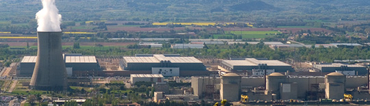
| Get guidance on how to use geostatistics for plant decommissioning survey program |
|
Geovariances has been actively involved in the American EPRI guide for using geostatistics in developing a site final status survey program for plant decommissioning. This report examines the use of geostatistical approaches that exploit spatial relationships to develop a three-dimensional contamination map...
|
| |
|
|
| |
|