
GEOSTATISTICS SOFTWARE
Isatis.neo · Geostatistics Software for Mining, Energy & Environment
Isatis.neo lets you predict what you haven't measured, and quantify the uncertainty of every estimate, so you can decide with confidence. From sparse measurements to 3D models, your entire geostatistical workflow — estimation, simulation, risk analysis — in a single platform.
What is Isatis.neo?
Isatis.neo is a geostatistics software platform developed by Geovariances, a Datamine company, and the global reference in geostatistics-based solutions. Designed for geoscientists and engineers, it transforms sparse field measurements into bidimensional or tridimensional spatial models, quantifies uncertainty at every step, and supports decision-making across mining, energy, environment, and bioresources industries.
Isatis.neo is the modern evolution of Isatis, first released in 1993 — over 30 years of continuous geostatistical R&D distilled into a single platform. It covers the full workflow, from exploratory data analysis and variography to estimation, simulation, and risk analysis.
Whatever your industry, Isatis.neo fits your challenges
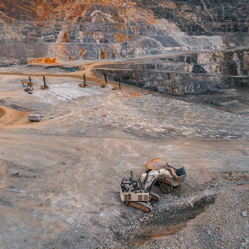
Grade estimation · Resource modeling · JORC / NI 43-101
Estimate grade and spatial distribution of minerals from blast and drill holes. Build robust resource models compliant with international reporting standards.
Better value my resources arrow_forward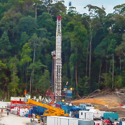
Oil & Gas · Gas Storage · Geothermal
Characterize your reservoirs from seismic and well data. Model volumes in place, facies heterogeneities, and quantify structural uncertainties.
Better quantify my volumes arrow_forward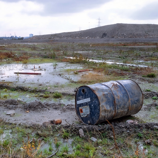
Contaminated Sites · Nuclear Decommissioning · Air Quality
Map pollutant distribution, quantify soil volumes to be treated, assess exposure risks, and produce auditable reports for regulatory authorities.
Better size my remediation arrow_forward arrow_forward For contaminated site characterization: see also Kartotrak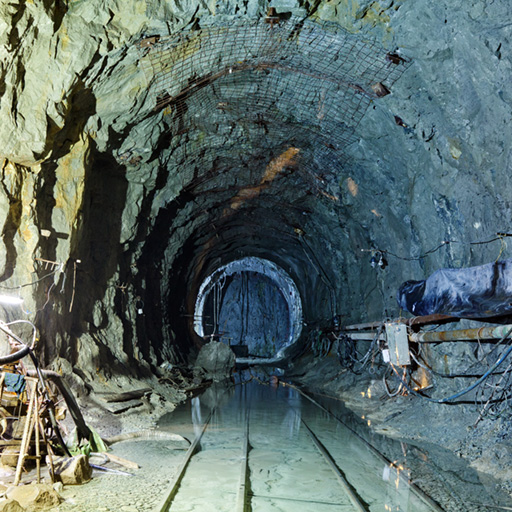
Geology · Hydrogeology · Geotechnics
Build 3D geological models integrating multi-source data. Characterize subsurface properties, assess spatial uncertainty, and support engineering decisions for foundations, water resources, and land stability.
Better characterize my subsurface arrow_forward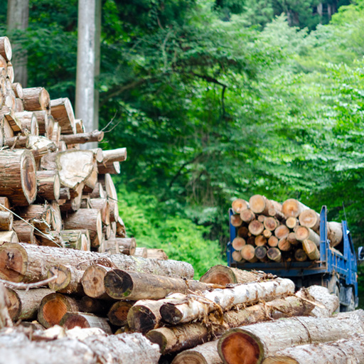
Forestry · Fisheries · Agriculture
Map renewable resource distribution and spatial variability. Estimate productivity and quality across landscapes, optimize sustainable management strategies, and quantify yield uncertainty for informed planning.
Better optimize my yields arrow_forwardFrom data to model, in a single tool
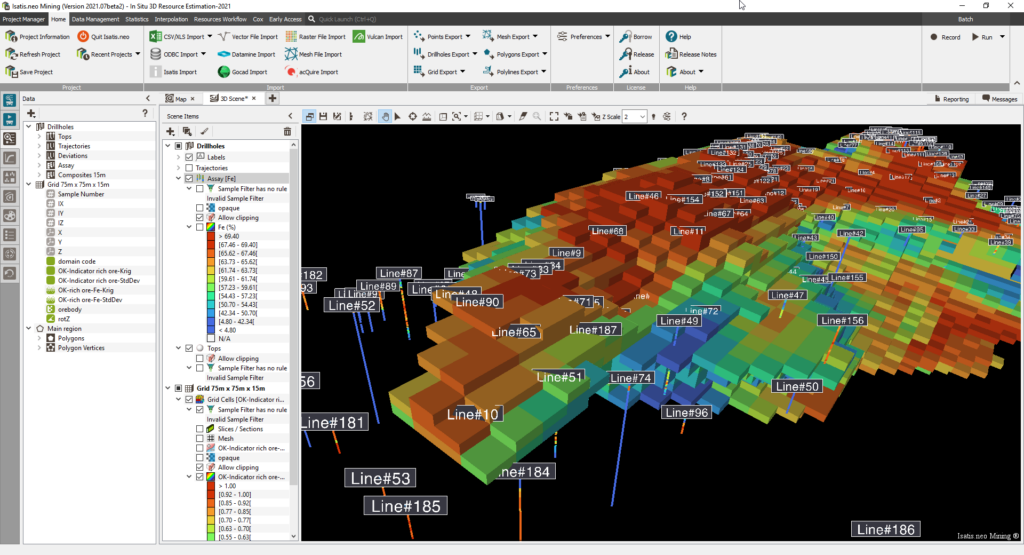
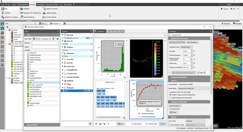
The widest choice of geostatistical techniques
Data Loading & Management
Import, clean, and structure your field data from any source.
Exploratory Data Analysis
Understand your data before any modeling: statistics, distributions, spatial structure.
Variography
Model the spatial continuity of your variable, the foundation of any kriging or simulation.
Estimation & Kriging
Produce the most probable estimate at every unsampled location, with local confidence indicators.
Simulations & Facies Modeling
Generate multiple equally probable realisations, capture the full range of variability.
Risk Analysis & Uncertainty Quantification
Turn simulation outputs into decision tools: exceedance probabilities, grade-tonnage curves, scenario comparison.
Reporting, Automation & Auditability
Export results, automate workflows, and ensure full traceability for regulatory compliance.
Why Professionals Choose Isatis.neo
Guided Interface
Pre-defined workflows reduce the learning curve without sacrificing technical depth.
Automation
Scriptable processes for repetitive tasks, ensuring consistency across large projects.
High Performance
Optimized for massive datasets, handling millions of blocks with speed and stability.
Continuous R&D
Direct access to the latest geostatistical innovations through our partnership with Mines Paris.
Auditable Results
Every step is recorded, providing full transparency for regulatory compliance.
Expert Support
Consult with our PhD-level geostatisticians to solve your most complex modeling challenges.
Guided Demo
A Geovariances consultant presents Isatis.neo and answers your specific questions. The most direct way to assess how well it fits your needs.
Request a demo arrow_forwardFree Trial
Full access to Isatis.neo for 2 weeks to 1 month, no commitment. Test all features at your own pace, on your own datasets.
Start evaluation arrow_forwardTalk to an Expert
Describe your challenge. Our geostatisticians will guide you, free of charge, toward the most appropriate solution within 48 hours.
Submit your request arrow_forwardTechnical Resources
Demos, webinars, white papers, and technical articles to discover the full potential of Isatis.neo.
Access resources arrow_forwardPrefer to code your workflows?
Isatis.py allows you to access the powerful Isatis.neo geostatistical library directly within your Python environment. Integrate advanced spatial statistics into your own data science pipelines.
Discover Isatis.py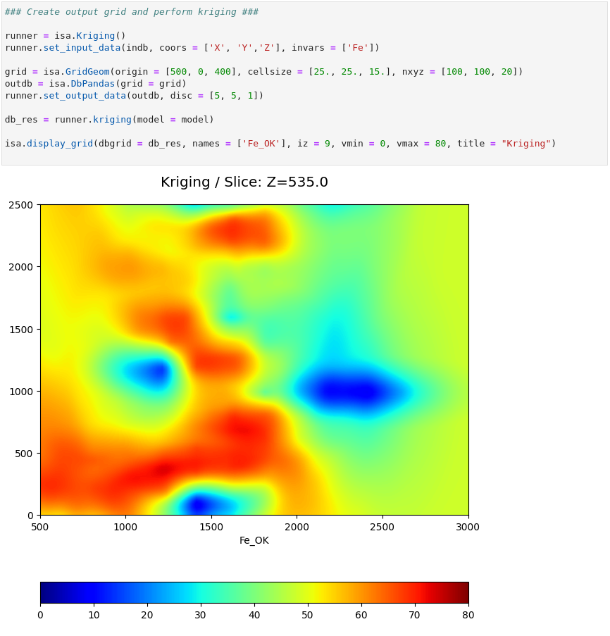
"The geostatistical workflow provided by Isatis.neo was remarkably agile and dynamic. This efficiency reflected in greater productivity, allowing me to focus on more complex analyses and strategic decisions that culminated in the generation of the final resource model."
"It’s worth highlighting the fast performance of Isatis.neo estimation and simulation modules. Over the past few weeks, I’ve been using these tools to work on triangulations and have been impressed. I’ve used them both to locate them in the block model using selections and to generate local rotations from complex solids."
"I use Isatis.neo to validate block models generated with other software. I also like its specific tools, such as Flattening, which I used to rotate a vein and allowed me to increase kriging efficiency from 40% to 70%."
Questions fréquentes
Tout ce que vous voulez savoir avant de nous contacter
How does Isatis.neo handle uncertainty? expand_more
Isatis.neo manages spatial uncertainty through two complementary approaches. The first is kriging variance, which accompanies every estimate with a local confidence indicator, quantifying how reliable the estimated value is at each unsampled location. The second is stochastic simulation, which generates a set of equally probable realizations of the studied phenomenon. From these realizations, Isatis.neo computes probabilities, exceedance thresholds, and risk quantifications, enabling decisions that account for the full range of possible outcomes rather than a single deterministic model.
What estimation and simulation methods are available in Isatis.neo? expand_more
Isatis.neo covers the full range of geostatistical methods. For estimation: ordinary, simple, universal kriging, cokriging, kriging with external drift, and non-linear methods including uniform conditioning and conditional expectation. For simulation: Sequential Gaussian Simulations (SGS), Turning Bands (TBS), Plurigaussian Simulations (PGS), Multiple-Point Statistics (MPS), and SPDE-based simulations. All simulation outputs feed directly into post- processing tools for risk quantification and probabilistic decision-making.
Does Isatis.neo support mineral resource estimation compliant with JORC, NI 43- 101, or CIM standards? expand_more
Yes. Isatis.neo is used by resource geologists and competent persons worldwide to produce mineral resource estimates that meet the requirements of major international reporting standards, including JORC, NI 43-101, and CIM. The software provides fully justified and traceable estimation parameters, complete audit trails, and reproducible workflows, all of which are required for compliant resource reporting.
What is the Isatis.neo Petroleum Edition and what does it add? expand_more
The Isatis.neo Petroleum Edition is a specialised version designed for reservoir geologists and geophysicists working in oil & gas and geothermal projects. In addition to the full geostatistical toolkit of the Standard Edition, it integrates the Conversions & Uncertainties workflow, a dedicated, preconfigured process for seismic time-to- depth conversion with comprehensive uncertainty analysis. This workflow enables probabilistic gross rock volume estimation, structural uncertainty assessment, and fault positioning uncertainty management — capabilities not available in any other geostatistics software.
What file formats and software does Isatis.neo connect to? expand_more
Isatis.neo supports an extensive range of formats used across geoscience industries, including CSV/Excel, LAS, Irap Classic, CPS-3, Eclipse GRDECL, SEG-Y, GeoTIFF, ArcGIS, NetCDF, ZMap, Shapefiles, Datamine (dm/dmx), Surpac, Vulcan, Leapfrog (MSH, LFM), and CAD mesh files (DXF, DWG, STL, OBJ, OFF). It connects directly to ODBC databases including acQuire, Microsoft SQL Server, PostgreSQL, and Fusion databases, as well as to Petrel® through a dedicated plugin. Isatis.neo also reads and writes data directly to and from Isatis.py, enabling seamless transitions between the graphical interface and Python-based workflows. For specific compatibility questions, our technical team is available to evaluate your environment.
Can Isatis.neo be used for environmental risk mapping and regulatory reporting? expand_more
Yes. Isatis.neo is used by environmental engineers and consultants for contaminated site characterization, nuclear decommissioning, and air and water quality mapping. It produces auditable, reproducible outputs with full parameter traceability — meeting the documentation requirements of regulatory authorities. For contaminated site characterization specifically, Geovariances also offers Kartotrak, a dedicated software solution that covers the full workflow from sampling design to remediation decision- making.
Does Isatis.neo integrate with Python? expand_more
Yes, in two ways. First, Isatis.neo includes a built-in Python calculator that allows users to create custom variables, functions, and post-processing scripts directly within the software — without exporting data to external tools. Second, Isatis.py is a companion library of ready-to- use geostatistical Python scripts that expose the full power of Isatis.neo’s algorithms in your own Python environment. Both solutions use identical algorithms, ensuring consistent results whether you work in the graphical interface or in code.
What level of expertise is required to use Isatis.neo? expand_more
Isatis.neo is designed for users at all levels. Its guided interface, data-driven parameters, and intuitive workflows make advanced geostatistics accessible to engineers and geologists who are new to the discipline. At the same time, its full range of advanced methods, batch scripting, and Python integration satisfy the most demanding expert users and researchers. Geovariances also offers a complete training catalogue, from introductory courses to advanced specialized sessions, to support teams at every stage of their geostatistical development.
How do I know if Isatis.neo is right for my specific use case? expand_more
Isatis.neo is available in three editions — Standard, Mining, and Petroleum — each tailored to a specific industry context. If you are unsure which edition fits your needs, or whether Isatis.neo is the right tool for your project, our geostatisticians are available to guide you free of charge within 48 hours. You can also request a guided demonstration on your own data, or access a free trial for up to one month to evaluate the software in your own environment, without commitment.
Contactez nos experts
Prêt à transformer vos données en décisions ? Nos experts vous répondent sous 48h.
Head Office
44 Avenue de Valvins, 77210 Avon, France