Skip to content

Geovariances is a Datamine company.    X

THE GLOBAL PROVIDER OF GEOSTATISTICS-BASED SOLUTIONS

   Access our blog  |  Subscribe to our newsletters  |  Contact us
    MY GEOVARIANCES        LOG IN   
Logo Geovariances
  • Industries
    • Mining Industry
    • Oil & Gas Industry
    • Nuclear Decommissioning
    • Contaminated Sites
    • Air, water, soil, bioresources and other
  • Software
    • Isatis.neo, accessible powerful geostatistics
    • Kartotrak, for contaminated site characterization
    • Isatis.py, Python package in geostatistics
    • On demand library and application development
    • Innovation
    • Technical support
  • Consulting
  • Training
    • Training offer
    • Upcoming training sessions
    • Training catalog
  • Resources
  • About us
    • What our clients say about us
    • Who we are
    • News
    • Events
DATA ACQUISITION AND ANALYSIS

Benefit from a sound exploratory data analysis to control and validate your input data. Identify data heterogeneities and characterize the contamination spatial variability in order to increase data value. In addition define and rationalise your sampling strategy according to your evaluation objectives.

DATA QUALITY CONTROL AND VALIDATION

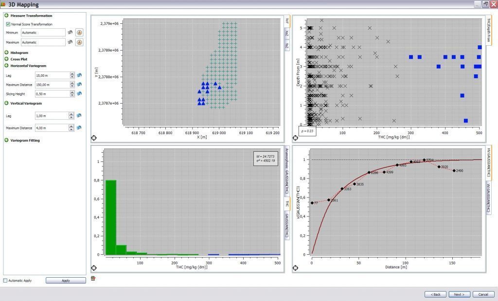
Before starting any pollution assessment, it is essential to control the quality of your data. This preliminary investigation and cleaning work allows ensuring strong basis and supplying reliability to your characterization process. Exploratory data analysis allows identifying and handling data anomalies, heterogeneities and anisotropies using appropriate statistical representations: basemap, histogram, q-q plot, variogram map, logs, 3D viewer. Integrate all qualitative and quantitative data (historical information, geophysics, indirect measurements), replace them in their environmental context and optimize your understanding of the contamination.


Exploratory data analysis with Kartotrak


SAMPLING DESIGN AND OPTIMIZATION

Geostatistics allows defining the most relevant sampling design according to the site characterization objectives that could be:

  • identification of target objects with known size,
  • delineation of the contamination extent,
  • validation of residual concentration/activity levels after remediation using classical statistical tests.


 IDENTIFICATION OF UNDER-SAMPLED AREAS

According to sampling density or more advanced uncertainty maps (confidence interval, probability of exceeding a threshold…), geostatistics helps in identifying missing data points that would improve significantly the characterization quality and reduce the associated uncertainties.

DISCOVER OUR SOFTWARE SOLUTIONS →
DISCOVER OUR CONSULTING SERVICES →

Contact

info@geovariances.com
EUROPE, AFRICA, ASIA, OCEANIA
Tel +33 (0)1 6074 9090
NORTH AMERICA
Tel +1 437 432 3346
SOUTH AMERICA
Tel +55 11 98384 9716

ANY QUESTIONS ?

If you would like to discuss your needs or an upcoming project, please feel free to contact us by completing this form.

Fill the form

MEDIA

  • Newsletter subscription
  • Blog posts
  • Press releases
  • Press review

CONNECT WITH US

Find our Jobs
©2025 Geovariances — All rights reserved. Privacy Policy, terms & conditions
website v2.757-3424654-develop - 2024-08-28@17:49:08

Operation in progress, please wait...


We use cookies on this website to enhance your user experience.

By continuing to navigate on this site, you accept that we deploy the strictly necessary cookies for its proper functioning and measuring traffic.

Note that our videos are hosted by Youtube. By watching them, you accept the terms and conditions of www.youtube.com.
Read our Privacy and Cookies Policy.

Got it

LOGIN TO OUR WEBSITE

Business Email *


Why be authenticated on our website?

• To have free access to your private space MY GEOVARIANCES for software and technical documentation download
• To benefit from free download of technical resources
• To fill any form without entering details again and again
• To register for a training course or a seminar in one mouse click

For any question, please contact webmaster@geovariances.com


Stay current with our news

Get some tips on how to use our software solutions. Be the first to hear about software updates and new features, the publication of blog articles, white papers or client stories. Keep your agenda up to date with our training sessions, webinars, and workshops.

Subscribe now to our emails, newsletters, and/or blog.

> SUBSCRIBE

MAKE AN ENQUIRY

If you have questions or would like to discuss your needs or an upcoming project, please feel free to contact us by completing this form. We are happy to help.