Geostatistics applied to mapping and risk assessment
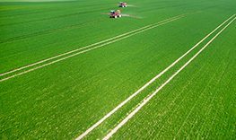
Apart from Mining, Oil & Gas and Contaminated Sites, geostatistics applies to a great variety of applications: air quality monitoring, subsurface modelling and natural hazards, biological resources, precision agriculture, not to mention other fields such as geochemistry, epidemiology, meteorology, forestry, archeology, etc.
Whatever the nature of your spatial data, geostatistics provide powerful and flexible solutions for spatial data analysis, sampling optimization, 2D/3D mapping and risk assessment.
Map any spatialized data and assess related uncertainties
OUR SOLUTIONS HELP IN...


Isatis.neo, the Gold Standard in Geostatistics
Complete Geostatistics. Simply Powerful. Discover Isatis.neo, the Gold Standard in Geostatistics
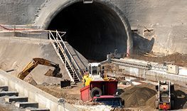
As part of a test carried out for Eiffage Génie Civil, Geovariances generated a subsurface model that was completely consistent with the one generated with their usual tools, with the added benefit of the geostatistical approach, speed and the arguments needed to justify it.
Dans le cadre d’un test réalisé pour Eiffage Génie Civil, Geovariances a généré un modèle de sous-sol complètement cohérent avec celui généré avec leurs outils habituels, avec en plus pour l'approche géostatistique, rapidité et arguments nécessaires à sa justification.

Maxwell GeoSystems help their clients reduce risk and improve construction performance. They integrate geostatistics with Isatis.neo in their modeling process to quantify the uncertainty of their interpretation for a greater understanding of the ground conditions.
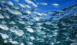
The French Marine Environmental Science Laboratory LEMAR has used Isatis in the framework of a spatial epidemiology study aiming at analyzing the origin and spread of marine viral diseases in oysters, so that to identify the main risk factors at the regional scale.
"Isatis is the only software that offers all the geostatistical functionalities in one single package. We access quickly and in the same way to advanced methodologies which have proven their effectiveness."
Hear from our customers
WHAT IS HAPPENING IN YOUR INDUSTRY?


Resources
-
Isatis.neo Standard Edition (version française)
-
Isatis.neo Standard Edition
-
2026 Training Catalog – Subsurface / Oil & Gas
-
Isatis.neo – Révélez la véritable nature du sous-sol – Développez votre compréhension de sa structure et de son hétérogénéité | Grâce à la géostatistique, transformez vos données en une vision claire et cohérente du sous-sol. Réduisez les incertitudes, optimisez vos modèles et prenez des décisions éclairées en toute confiance.
-
Isatis.neo – Reveal the true nature of the subsurface. Gain a reliable understanding of subsoil structure and heterogeneity | Integrate geostatistics into your modeling workflow to uncover deeper insights, reduce uncertainty, and make smarter, risk-informed decisions with confidence.


Hydrogeological Facies Modeling
Stochastic Methods for geological modeling and links with fluid flow simulations
Whatever the application domain – oil & gas production, aquifer pollution characterization, uranium production by lixiviation – characterizing the geological parameters and capturing their variability is essential to ensure realistic flow modeling…
Geological Facies Simulations
Whatever the resource involved – oil & gas, coal or metallic resources – capturing the variability of the geological parameters is essential at the modelling stage as the characteristics of the distributions of key parameters conditioning the resource recovery (e.g. rock properties, grades, etc.) are informed by the geological context. A large variety of simulation techniques is available to model geological facies.
Through Geovariances strong experience in developing successfully simulation strategies for different geological environments (e.g. kimberlite pipes, turbiditic and carbonate reservoirs, porphyry copper, hydrothermal type deposits, etc.), learn how to choose the best facies modelling technique according to the specific geological depositional environment. Analyse each method advantages and drawbacks.
-
Application de la géostatistique dans l’analyse de risque géotechnique lié à la liquéfaction du sol (vidéo) | Gestion des Données et Nouvel Environnement numérique en Géotechnique - Journée technique CFMS 15 nov 2022
-
Utilisation d’un algorithme de classification par Machine Learning pour la caractérisation géomécanique des sols | CFMS 2020 - par Marie-Cecile Febvey
-
Spatial uncertainty quantification of extreme cold temperature return periods in Quebec using multivariate turning bands simulation | D. Tapsoba (Hydro-Québec), P. Masoudi (Geovariances) & X. Emery (Universidad de Chile) – Stoch Environ Res Risk Assess 40, 110 (2026)
-
Applicability of predicted cone penetration test profiles from geostatistical co-simulation on deterministic and probabilistic monopile foundation design for offshore wind turbines | Authors: L. Siemann (IWES), S. Wilhelm (GuD Consult), P. Masoudi (Geovariances), R. Relanez (IWES), P. Arnold (GuD Consult), B. Schwarz (IWES), F. Rackwitz (Technical University of Berlin), T. Mörz (University of Bremen) - Published in Ocean Engineering, Volume 355, Part 2, 2026
-
Probabilistic Modeling of Hourly Precipitation Jointly with ERA5-Land: Application of Geostatistical Simulations | Tapsoba D. (Hydro-Québec Research Institute (IREQ)), Rousseau-Rizzi (Hydro-Québec Research Institute (IREQ)), R., Masoudi P. (Geovariances), Lemarchand O. (Geovariances) - Published in Save article Mathematical Geosciences (2026)
-
Stratigraphic and Geotechnical Modelling by Geostatistics, Applied to Penetrometer and Menard Pressure-Meter Tests | Masoudi, P., Simon, C., Faucheux, C. et al. - Mathematical Geosciences (2025). https://doi.org/10.1007/s11004-025-10242-0
-
Assessing paleo-channel distribution for probabilistic offshore windfarm ground modelling using Multiple-Point Statistics | Lennart Siemann, Ramiro Relanez - Fraunhofer Institute for Wind Energy Systems IWES - Presented at EAGE Annual 2025, Toulouse