Kartotrak, the integrated software solution for contamination characterization
Kartotrak is the first all-in-one software solution designed for an efficient characterization of soil contamination. It has been conceived for all those in charge of environmental site assessment or remediation who need to locate and estimate contaminated soil volumes confidently. Kartotrak offers an integrated workflow that streamlines the characterization process and can be used at any step of a remediation project: during the scoping and the characterization phase or after remediation to verify site compliance with cleanup regulatory rules.
![]() A light version of Kartotrak, Kartotrak.one, is available for those who only need data QC and rapid contamination mapping functionalities.
A light version of Kartotrak, Kartotrak.one, is available for those who only need data QC and rapid contamination mapping functionalities.
> Read more
IMPROVE YOUR CONCEPTUAL SITE MODEL
Because you need to be confident with data quality in order to produce reliable results, Kartotrak offers high-value exploratory data analysis tools for an in-depth quality control. Its integrated Geographical Information System and 3D Viewer help you improve your contamination knowledge and identify key uncertain areas.
SAVE TIME AND GAIN PRODUCTIVITY
Kartotrak is very easy to handle and its workflow guides you through each step of your project, simplifying software manipulation. Once parametrized, you can repeat the whole Kartotrak workflow in just a few clicks. You can implement Kartotrak on-site for real-time data acquisition or at the office for in-depth analysis including risk management studies and setup of excavation plans.
OPTIMIZE CHARACTERIZATION AND REMEDIATION COSTS
Kartotrak provides efficient tools for sampling optimization and risk assessment, enabling you to better anticipate hazards during remediation and consequently to better estimate the project costs. You can control key uncertainties related to contaminated volumes or pollutant masses and identify areas that are either sub-sampled or with an increased heterogeneity.
IMPROVE YOUR DECISION-MAKING PROCESS
Kartotrak 2D/3D mapping functionalities allow you assessing efficiently the soil compatibility with the site’s future use or its surrounding environment. Kartotrak facilitates communication between stakeholders thanks to its 2D/3D visualization components, therefore providing you with strong basis to your decision process.

Faced with 500,000 m³ of excavated soil of heterogeneous quality, HAROPA PORT used geostatistical simulations to classify soils across 5 disposal routes, quantify threshold exceedance probabilities, and secure the budget of a major port infrastructure project.
Avec plus de 500 000 m³ de déblais hétérogènes, HAROPA PORT a eu recours aux simulations géostatistiques pour classer les terres selon 5 filières de gestion, quantifier les probabilités de dépassement de seuils et sécuriser le budget d'un grand projet portuaire.

RSK Environnement optimise ses études de sols contaminés grâce à Kartotrak. La modélisation 2D/3D avancée et l'analyse des incertitudes permettent d'obtenir des diagnostics plus précis et de prendre des décisions plus éclairées.
RSK Environnement boosts contaminated soil studies with Kartotrak. Advanced 2D/3D modeling and uncertainty analysis provide more accurate diagnostics and stronger decision-making.
Ginger BURGEAP utilise Kartotrak pour établir les bilans de masse, définir les zones de pollution concentrée ou quantifier les volumes pollués. Les points forts de Kartotrak ? La visualisation en 3D de la contamination, la robustesse des résultats et la rapidité de mise en œuvre.
Testimonials
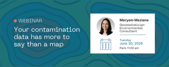
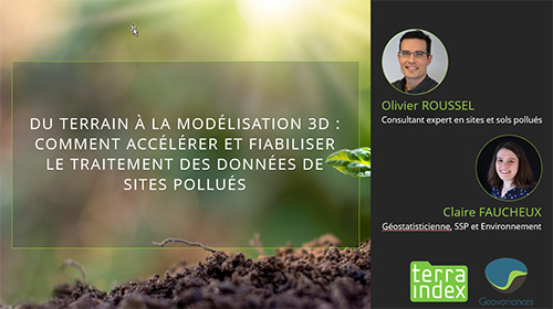
DISCOVER KARTOTRAK AT OUR UPCOMING EVENTS
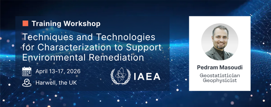


Events

Resources
-
Kartotrak – Renforcez la précision de vos diagnostics de sites contaminés et optimisez vos plans de réhabilitation et de démantèlement avec la géostatistique | Optimisez vos campagnes d’échantillonnage et réduisez les coûts. Affinez la caractérisation de contaminations chimiques ou radioactives. Trouvez le juste équilibre entre performance de la réhabilitation et volume de déchets grâce à des analyses de risque robustes.
-
Kartotrak – Improve contaminated site diagnosis and optimize remediation and decommissioning plans with geostatistics | Optimize sampling campaigns and save on costs. Improve contamination characterization, whether chemical or radioactive. Balance remediation efficiency and waste volumes and make the best decision.
-
Software licensing system & operating system requirements | Geovariances - Software licensing system & operating system requirements
-
Kartotrak | How confident are you with your management plan quality?
-
Kartotrak | Etes-vous sûr de la qualité de vos plans de gestion ?


Data Quality Control
Before starting an evaluation of the contamination leading to decision-making tools for site clean-up, it is essential to ensure data quality. Thus, based on solid and reliable foundations, uncertainties occurring during the different steps of the decision process will be better controlled and the final quality of the project improved.
The objective of this white paper is to assess at best the validity of the data through visual, statistical and geostatistical basic tools before going further into their analysis.

Dose Rate Mapping
The objective of any serious mapping is to obtain a realistic and reliable image of the studied phenomenon. Concerning dose rate, maps are often derived from punctual measurements interpolated using deterministic methods. Sometimes, the choice of the inverse distance squared weighted interpolation is wrongly justified by the fact that the dose rate issued from a punctual source is theoretically inversely proportional to the squared distance between the source and the measurement point.
Through this white paper, find out why this inverse distance squared weighted interpolation is not the appropriate method for dose rate mapping and why the geostatistical approach by kriging is the solution for a quality and reliable mapping.
-
Geostatistical mapping of a contaminated riverbank in Norway – ICRER 2022 | ICRER 2022 - T. K. Eriksen (Institute for Energy Technology, NUK Kjeller, Norway) and Y. Desnoyers (Geovariances)
-
Geostatistical mapping of two nuclear sites in Norway – ICRER 2022 | ICRER 2022 - M. Bourgeaux-Goget (IFE) and Y. Desnoyers (Geovariances)
-
Characterization of Radioactively Contaminated Land – IAEA Nuclear Back End Webinar Series 3.5
-
Methodology for the Estimation of Contaminated soil by a Geostatistics-based method | WM2023 - E. Moreno (CEA Marcoule), Y. Desnoyers (Geovariances), I. Bisel (CEA Marcoule) and P. Marty (CEA Marcoule)
-
Contributions of the CETAMA working group n°10 on sampling and radiological characterisation (poster) | Anne Courtadon et Danièle Roudil, CEA Marcoule; Yvon Desnoyers, Geovariances; Didier Dubot, CEA; Guy Granier, IRSN; Catherine Ollivier-Dehaye, EDF
-
Methodology for Contamination Estimation by a Geostatistic-based Method | WM2023 - E. Moreno (CEA Marcoule), Y. Desnoyers (Geovariances), I. Bisel (CEA Marcoule) and P. Marty (CEA Marcoule)
-
Smart use of the variogram to explore spatial data, break down variance contributions and model radiological contaminations | by Yvon Desnoyers - Presented at the workshop "Statistical methods for safety and decommissioning" - Nov. 22-24, 2022 - Research Group MASCOT-NUM
-
Metallographic characterization by variographic analysis and geostatistical simulation of local segregation microstructures in a heavy thickness forged part in SA508 Gr3 Cl2 type steel | FONTEVRAUD 10, 2022 - Y. Desnoyers (Geovariances), P. Masoudi (Geovariances), P. Joly (Framatome), E. Deneuvillers (Framatome)
-
Kartotrak, software solution for contaminated site and soil characterization | Kartotrak, software solution for contaminated site and soil characterization
-
Geostatistical deconvolution to find and locate punctual sources | Geostatistical deconvolution to find and locate punctual sources