Skip to content

Geovariances is a Datamine company.    X

THE GLOBAL PROVIDER OF GEOSTATISTICS-BASED SOLUTIONS

   Access our blog  |  Subscribe to our newsletters  |  Contact us
    MY GEOVARIANCES        LOG IN   
Logo Geovariances
  • Industries
    • Mining Industry
    • Oil & Gas Industry
    • Nuclear Decommissioning
    • Contaminated Sites
    • Air, water, soil, bioresources and other
  • Software
    • Isatis.neo, accessible powerful geostatistics
    • Kartotrak, for contaminated site characterization
    • Isatis.py, Python package in geostatistics
    • On demand library and application development
    • Innovation
    • Technical support
  • Consulting
  • Training
    • Training offer
    • Upcoming training sessions
    • Training catalog
  • Resources
  • About us
    • What our clients say about us
    • Who we are
    • News
    • Events
MODEL VALIDATION AND RECONCILIATION

Checking the validity and robustness of any resource estimate is a mandatory step to ensure models remain current and useful. Key avenues for validation and reconciliation are:
– Geostatistical inspection of resource estimates and benchmarking against data inputs; and
– Reconciliation of production outcomes with grade control models and exploration resource estimates (e.g. using past and current production information to improve the predictive performance of your models).

Geostatistics is particularly well-suited to test and check:


Contact analysis with Isatis
                                      Contact analysis with Isatis

1/ The internal consistency of the model (check hypotheses, reproduction of input parameters):

  • Grade architecture: helps you chose the change of support models adapted to your deposit; and
  • Compare grade tonnage curves produced by your estimates (OK, UC, CS…) with theoretical curves based on samples and change of support model.


2/ The statistical compatibility of the estimates with input parameters:

  • Global checks: statistics, histograms, variograms; and
  • Local checks: scatter plots, q-q plots, swathplots, boxplots.


3/ The validity of the estimation domains used:

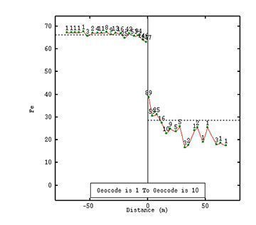
  • Border effect and contact analysis (samples/models):
    these two complementary tools are used to qualify how domains should be treated at estimation (i.e. hard/soft boundary, definition of transition domains etc.);
  • Response of estimates to combination/sub-division of domains; and
  • Uncertainty on estimation volumes/tonnages.


4/ The use of production dig line to reconcile models at different scales with actual production data and propose mediatory actions;


5/ Time-sampling and reconciliation at the mill; and


6/ QAQC points, control charts

DISCOVER OUR SOFTWARE SOLUTIONS →
DISCOVER OUR CONSULTING SERVICES →

Contact

info@geovariances.com
EUROPE, AFRICA, ASIA, OCEANIA
Tel +33 (0)1 6074 9090
NORTH AMERICA
Tel +1 437 432 3346
SOUTH AMERICA
Tel +55 11 98384 9716

ANY QUESTIONS ?

If you would like to discuss your needs or an upcoming project, please feel free to contact us by completing this form.

Fill the form

MEDIA

  • Newsletter subscription
  • Blog posts
  • Press releases
  • Press review

CONNECT WITH US

Find our Jobs
©2025 Geovariances — All rights reserved. Privacy Policy, terms & conditions
website v2.757-3424654-develop - 2024-08-28@17:49:08

Operation in progress, please wait...


We use cookies on this website to enhance your user experience.

By continuing to navigate on this site, you accept that we deploy the strictly necessary cookies for its proper functioning and measuring traffic.

Note that our videos are hosted by Youtube. By watching them, you accept the terms and conditions of www.youtube.com.
Read our Privacy and Cookies Policy.

Got it

LOGIN TO OUR WEBSITE

Business Email *


Why be authenticated on our website?

• To have free access to your private space MY GEOVARIANCES for software and technical documentation download
• To benefit from free download of technical resources
• To fill any form without entering details again and again
• To register for a training course or a seminar in one mouse click

For any question, please contact webmaster@geovariances.com


Stay current with our news

Get some tips on how to use our software solutions. Be the first to hear about software updates and new features, the publication of blog articles, white papers or client stories. Keep your agenda up to date with our training sessions, webinars, and workshops.

Subscribe now to our emails, newsletters, and/or blog.

> SUBSCRIBE

MAKE AN ENQUIRY

If you have questions or would like to discuss your needs or an upcoming project, please feel free to contact us by completing this form. We are happy to help.