How Imerys transforms data scarcity into a robust model through simulations
Faced with sparse drilling data in the northern extension of its Rodoretto talc mine, Imerys leveraged the advanced simulation capabilities of Isatis.neo, first using multiple-point statistics (MPS) and then plurigaussian simulations (PGS), to model lithologies and grades, with methodological support from Geovariances.
A world leader in industrial mineral specialties, Imerys extracts and transforms a wide range of minerals – kaolin, talc, bentonite, diatomite, perlite, feldspar, calcium carbonate, and graphite – from mining sites around the world. This mastery, from extraction to transformation, enables Imerys to deliver tailor-made technical solutions across a wide array of industries.
THE CHALLENGE
Sparse Data in a Strategic Zone
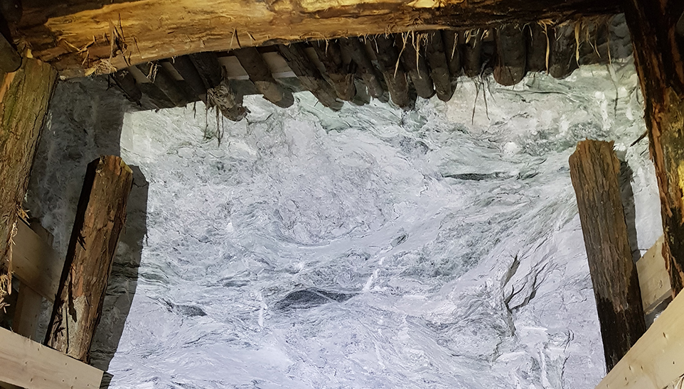
In the underground Rodoretto talc mine in northern Italy, the Imerys geology team faced a major challenge: accurately estimating resources in a new exploration area, the Northern Extension, which is a natural continuation of the currently mined Northern zone but sparsely sampled.
Although the extension shared a similar geological setting with the adjacent well-documented zone, only three drill holes were spaced at 25-meter intervals, whereas a reliable model would require one every 10 meters. This low data density made it difficult to precisely estimate the volume and quality of the talc.
To address the insufficient number of samples, it was important to consider alternative methods to kriging for accurately estimating talc resources.
THE SOLUTION
Exploring Alternatives to Traditional Kriging
Imerys had previously worked with Geovariances through geostatistics training courses, where simulation methods such as Multiple-point Statistics (MPS) had been introduced. The team was particularly interested in MPS for its potential to use the knowledge from the Northern zone as a training image.
The idea of launching a geostatistical simulation project using Geovariances’ tools soon emerged, along with personalized support to refine the methodology.
Tool + expertise: unlocking the data value
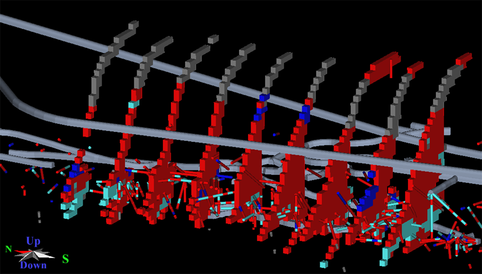
1| The team naturally chose Isatis.neo, a powerful and intuitive geostatistical software fully compatible with other geology and mine planning tools used by Imerys. Isatis.neo facilitated the integration of multiple data sources: drill holes, 3D envelope of the talc vein, and mapped faces of production galleries.
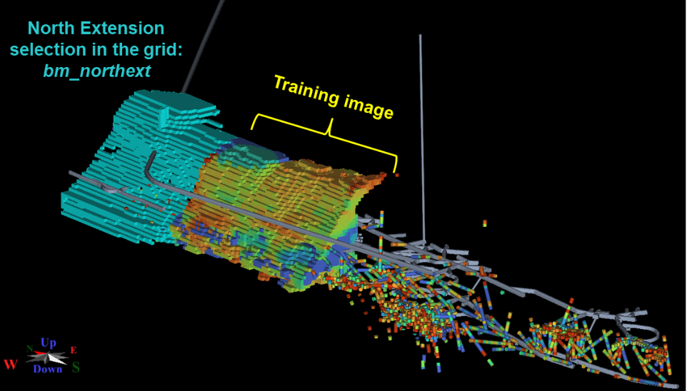
2| The project began with MPS simulations, using the Northern zone as a training image to estimate talc percentage per block. However, despite multiple attempts, the results appeared too smoothed, with a loss of statistical representativeness.
3| The objective was then adjusted: instead of estimating a percentage, the team shifted to assigning a lithology per block (talc, carbonate, mica schist). This time, the plurigaussian simulations (PGS) proved to be more suitable. Isatis.neo supported the statistical analysis, spatial visualization, Gaussian transformation, and execution of the simulations.
A key success factor was the personalized support from Geovariances experts, who helped resolve tool configuration issues and optimize the parameters.
OUTCOMES
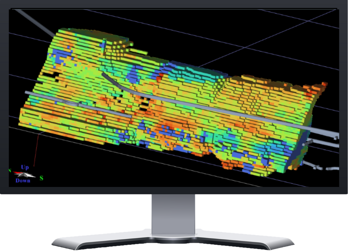 3D model of talc percentage
The project yielded multiple benefits:
- Improved deposit understanding
The PGS method generated extraction-level maps that now support production team decisions.
- Skills development
Geovariances’ support significantly enhanced the team’s expertise in advanced simulation methods.
- Flexibility and agility
The ability to test different approaches in an intuitive environment allowed for agile adaptation based on results.
- Progressive validation
The first level of the Northern Extension has been opened, and comparing simulated results with actual extraction data will enable progressive model reconciliation.
CONCLUSION
A Strategy That Opens New Avenues
Through the advanced simulations of Isatis.neo and expert support from Geovariances, Imerys successfully overcame data scarcity to reliably model talc resources in Rodoretto’s Northern Extension. This project strengthens an agile and structured geostatistical approach to support the future of the mine.