Isatis.neo is a comprehensive, modular, and high-performance geostatistics software designed for technical professionals in mining, oil and gas, environmental, geotechnical, and other related fields. It combines advanced statistical rigor with workflow flexibility and complete transparency, empowering users to build robust spatial models with precision and confidence.
Isatis.neo is available in three versions: Standard, Mining, and Petroleum.
Ready to elevate your geostatistical modeling?
Or reach out to our team at info@geovariances.com
Why geoscientists choose Isatis.neo
Designed by geostatisticians, for geostatisticians
Transparent, reproducible processes with traceability
Highly configurable for expert users, with automation options for efficiency
Backed by Geovariances’ 40 years of expertise in applied geostatistics
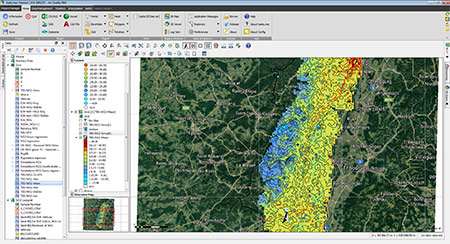
Flexible Data Management for 2D and 3D Modeling
- Supports various data types: points, drillholes, blocks, grids, and meshes.
- Intuitive interfaces for importing and exporting standard industry formats: CSV, Excel, ASCII, SEG-Y, GeoTIFF.
- Fully compatible with legacy formats from acQuire, Datamine, Eclipse, Gocad, Leapfrog, Petrel, Vulcan, GSLIB, and Isatis.
- Comprehensive tools for data management, manipulation, and variable creation.
- Systematic naming of outputs for consistency and streamlined workflows.
Advanced Statistical Exploration & Preparation
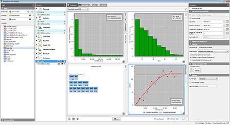
- Interactive, linked graphics: histograms, box plots, cross-plots, swath plots, variograms for detailed analysis.
- Sophisticated variography (multivariate/multi-directional/downhole), with powerful automatic model fitting.
- Multivariate analysis: Principal Component Analysis (PCA), Min/Max Autocorrelation Factors (MAF), or Projection Pursuit Multivariate Transform (PPMT) for correlation analysis and variable decorrelation.
- Preprocessing tools: drillhole compositing, declustering, normal score transform, outlier identification, homogeneous sample grouping for domain modeling, capping tools for heavy-tailed distributions.
Robust & Customizable Geostatistical Modeling
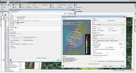
- Full range of interpolation methods: nearest neighbor, inverse distance, moving average, moving median, kriging (ordinary, simple, universal, spline, linear, external drift).
- Advanced modeling features: co-kriging, kriging with faults, local parameters, and variance of measurement error, rescaled cokriging for noisy data and negative values, Mixed Support Kriging for multi-scale data.
- Kriging Neighborhood Analysis (KNA) for optimal sample selection.
- Morphological operations for grid cleanup.
Simulations & Risk Analysis Tools
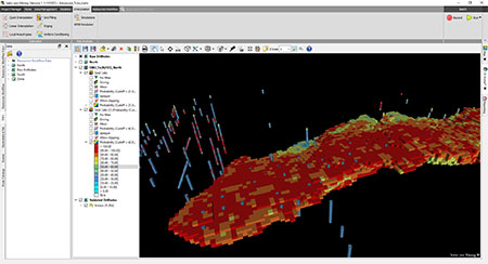
- Conditional and non-conditional simulations, with uncertainty quantification and scenario analysis.
- Direct Block Simulations for bypassing point-scale models, saving considerable time and disk space.
- Post-simulation tools: volumetrics, uncertainty maps, grade-tonnage curves, Parker’s classification
- Simulation reduction to extract representative subsets while maintaining statistical integrity.
- Conditional expectation modeling for probabilistic assessments.
Facies & Complex Structure Modeling
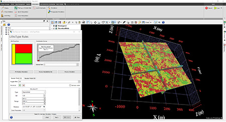
- Sequential Indicator Simulations (SIS).
- Plurigaussian Simulation (PGS) with rule editor and transition probability matrix display.
- Multiple-point Statistics (MPS) for reproducing training image patterns.
Designed for geologically complex environments (e.g., conjugate veins, reefs, lithotype constraints).
Automation, Integration & Auditability
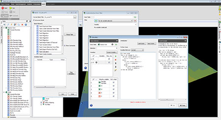
- Built-in workflow manager for repeatable, auditable geostatistical processes.
- Batch mode and scripting for high-throughput processing and automation.
- Python-enabled calculator to generate variables and functions.
- Batch Editor and script files for complete traceability and auditing.
- Seamless Python interface for accessing the Isatis.neo database and facilitating external integration.
Model Validation & Error Tracking
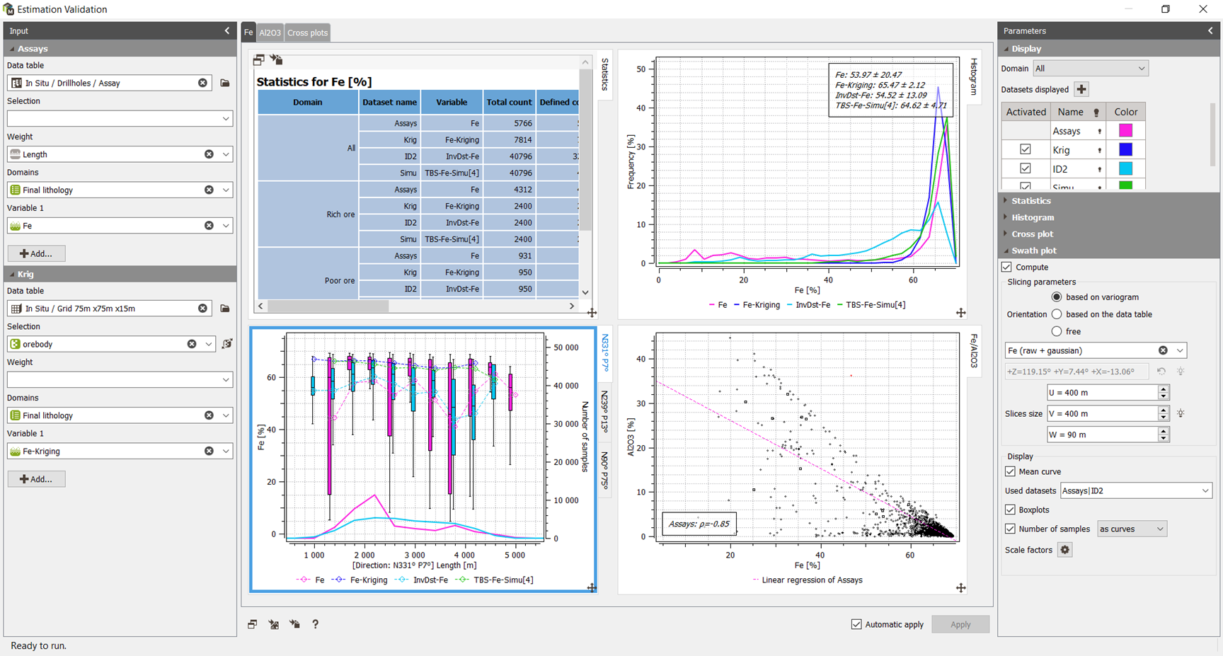
- Multivariate cross-validation.
- Validation tools to compare estimation/simulation outputs with original data (distributions, variograms).
- Interactive plots for comprehensive variable inspection.
Reporting & Visualization
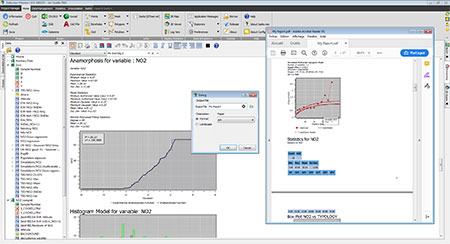
- Integrated GIS-like viewer and 3D visualization tools
- On-the-fly report generation using the built-in word processor.
- Export reports in PDF or ODT formats with fully formatted content.
Tailored Features for Industry Needs
- Mining: UC, MIK, cut-off optimization, domain modeling, grade-tonnage reporting, contact and connectivity analysis.
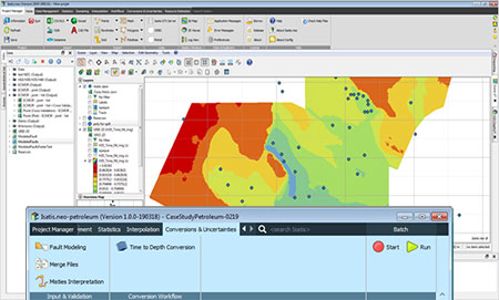
- Oil & Gas: Time-to-depth conversion, reservoir volumetrics, facies simulation, petrophysical modeling.
- Subsurface industries: spatial variability modeling of soil parameters, geological modeling.
- Other industries: mapping, exceedance probability maps, threshold-based analysis.