Geovariances launches the version 2020.06 of Isatis.neo, their user-friendly and comprehensive software solution in Geostatistics.
With this new version of Isatis.neo, Geovariances continues the deployment of advanced geostatistical techniques. In particular, we have added the Plurigaussian Simulations for facies modeling and developed further a kriging option allowing efficient mineral resource classification.
Model complex geology thanks to a powerful algorithm
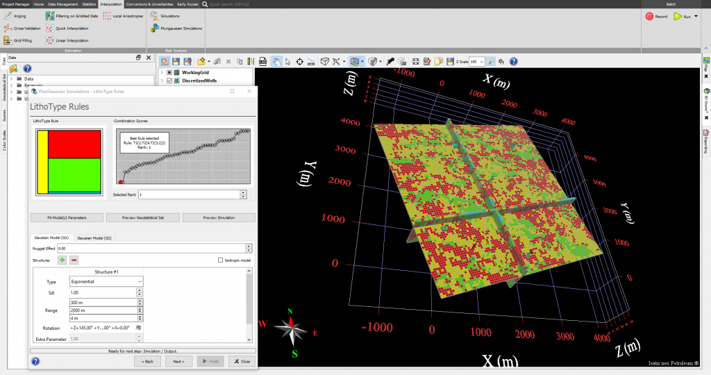
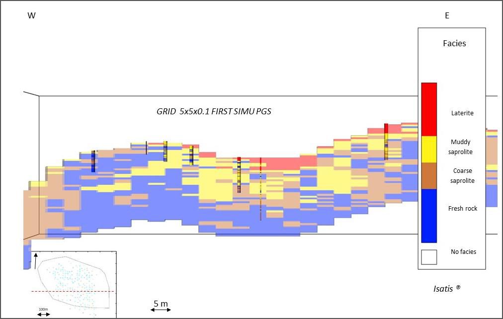
One of the new key features of this release is the ability to produce detailed and geologically sound facies models using the Plurigaussian Simulations. This technique is specifically designed to model complex geology with different structure orientations and heterogeneous deposits such as channels, reefs, bars, sets of conjugate veins, or ore types where geological constraints apply. It enables fine control of facies relationships and boundaries through a lithotype rule and a matrix of facies proportions derived from drill-hole data. The strength of the Isatis.neo implementation is that it can automatically perform the inference of the lithotype rule and underlying gaussian models thanks to a powerful algorithm.
Improve the quality of the variographic analysis and estimates
In situations of folded bodies, users can now perform data “unfolding” by vertical or perpendicular to a surface data translation. The process allows aligning the grades measured along the same stratigraphic level and improves the quality of the variographic analysis and estimates.
Derive grade tonnage curves quickly
[Mining Edition only] The software also adds a comprehensive and powerful tool to derive grade tonnage curves quickly from various data (grade estimates, tonnage, and metal quantity as may be calculated by Uniform Conditioning or MIK, anamorphosis function) either globally, or in selected domains. It also reports tonnages and metal quantities by level of the grid.
Classify efficiently mineral resources
[Mining Edition only] The kriging option “Sampling Density Variance” has been developed further to provide a robust mineral resource classification, independent from sample number, block size, and domain extension.
About Isatis.neo
Isatis.neo leverages the technology of its predecessor and reference software, Isatis. It offers, in an easy-to-use interface, a wide choice of statistical and geostatistical techniques for data analysis, mapping, block modeling, resource estimation, and classification, as well as the ability to perform accurate risk analysis. It is a scalable software solution that meets the whole resource team’s needs. It allows resource managers to set up estimation workflows that will be automated to streamline mine geologists’ daily tasks.
More information about Isatis.neo: https://www.geovariances.com/en/software/isatis-neo-geostatistics-software/
About Geovariances
Founded in 1986 and headquartered in France with offices in Brazil, Chile, and Australia, Geovariances has been a world leader in applied geostatistics for 35 years. The company provides data analysis, mapping, resource estimation, reservoir modeling, and risk analysis to clients across the globe through geostatistics-based software solutions, training and consulting services. Employing only highly qualified specialists, Geovariances is a frontrunner in ensuring clients with reliable and scientifically accurate solutions. Geovariances’ primary markets include the Mining, Upstream Oil and Gas, Nuclear Decommissioning and Contaminated Sites industries, and many other sectors.
More information about Geovariances: https://www.geovariances.com/