The quality of seismic volumes is critical in building reliable reservoir models. Seismic data are often polluted by artifacts which have strong impact on subsequent processing or interpretation. Geostatistics allows filtering seismic noise and artifacts without modifying the signal.
Filtering is frequently required in order to remove undesirable noise (acquisition footprint, patterns due to oriented processing windows, random noise) on various seismic attributes (e.g. velocities, amplitudes). In comparison with standard geophysical filters such as Wiener, Median or F-k, factorial kriging (Matheron, 1982) allows removing artifacts that are spatially correlated.
The geostatistical seismic data enhancement workflow is made of several steps:
INDEPENDANT QUALITY CONTROL
Controlling data quality is compulsory in order to identify artifacts or anomalies. Geostatistics is particularly well suited for this task, allowing an independent review of the data quality that can be achieved at any step in your process. Geostatistics enables quantifying the magnitude of artifacts and subsequently the quality of the processing. Geostatistical tools allow a control of spatial coherence of events related to seismic velocities.
SETTING STATISTICAL EVIDENCE OF ANOMALIES
Directional statistics allow highlighting zones with special characteristics or the presence of test lines. The principal benefit is to emphasize inconsistencies such as seismic folds during acquisition (around the wells). Geological effects can also be highlighted like salt bodies, strong slopes and important thickness differences. Experimental variogram is an essential tool for the structural interpretation of the data. It gives quantitative and qualitative information on major spatial data structures.
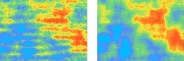
FILTERING BASED ON THE CHARACTERIZATION OF SPATIAL CONTINUITY
Geostatistics allows analyzing seismic data through a probabilistic approach based on a spatial variability analysis. Geostatistics characterizes the intrinsic structure of the parameter in order to take into account the continuity of your data and introduce the geology by capturing the geological structures.
Geostatistical filtering allows the removal of acquisition footprints, patterns due to oriented picking, white or coherent noise on velocities or amplitudes.
Filtering and quality control are possible on 2D/3D gridded data but also on scattered data such as seismic picks.
The geostatistical seismic data enhancement workflow has several advantages:
GEOLOGICAL TRENDS TAKEN INTO ACCOUNT
Geostatistical tools deal with non-stationary features such as vertical trends. The seismic provides a shape function with stationary residuals on top of it. The calibration of velocity functions and models takes into account wells and seismic data as well as geological features and velocity trends.
INTEGRATION OF VARIOUS DATA
Geostatistics allows merging several data sets (different acquisition techniques or vintages in 4D seismic framework) in a single coherent velocity cube using multivariate kriging techniques.