Geostatistics for optimizing reservoir characterization
Geostatistics provides the most efficient framework to build accurate and reliable static models of reservoirs.
Geostatistics is valuable at all steps of the geomodeling process:
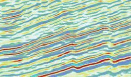
- Seismic data quality control and enhancement;
- Time-to-depth conversion and optimal mapping of horizons;
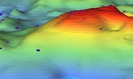
- Structural uncertainty quantification;
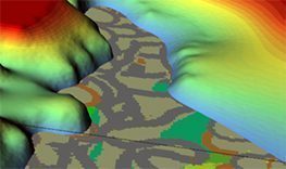
- Rock-typing;
- Facies distribution in various geological environments;
- Petrophysical properties distribution;
- Uncertainty quantification on Volumetrics.
Geovariances puts its Oil & Gas industry knowledge, continuous innovation and geostatistical expertise at your service to guarantee the quality and reliability of your geological models.
Optimize your reservoir static models
Using our solutions, you can...

Isatis.neo, the Gold Standard in Geostatistics
Complete Geostatistics. Simply Powerful. Discover Isatis.neo, the Gold Standard in Geostatistics
"Conversions & Uncertainties Workflow is an operational tool that can eventually add value to our portfolio of prospects thanks to robust, reliable and easy-to-compare methodology. That is really a huge improvement."

"The cooperation with Geovariances experts has allowed our team members to improve their knowledge in stochastic modeling and connectivity issues."
"Our partnership with Geovariances for the leading of a geostatistics training module is historical AND is still being reinforced thanks to the professional quality and thoroughness of the company’s services."
“Isatis Grid Operator is really a high-performance tool. It allows us to achieve connectivity analysis on huge seismic volumes in half an hour, even on about 2 billion-cell grids, compared to the several hours it usually takes with other software packages."
Suncor Energy used Isatis in one of its most important projects for high resolution 3D geological modelling of their oil sands mining property.
Hear from our customers
What is happening in your industry?


Resources
-
Conversions & Uncertainties Workflow – Isatis.neo Petroleum Edition
-
Isatis.neo Petroleum Edition
-
2026 Training Catalog – Subsurface / Oil & Gas
-
Isatis.neo – Révélez la véritable nature du sous-sol – Développez votre compréhension de sa structure et de son hétérogénéité | Grâce à la géostatistique, transformez vos données en une vision claire et cohérente du sous-sol. Réduisez les incertitudes, optimisez vos modèles et prenez des décisions éclairées en toute confiance.
-
Isatis.neo – Reveal the true nature of the subsurface. Gain a reliable understanding of subsoil structure and heterogeneity | Integrate geostatistics into your modeling workflow to uncover deeper insights, reduce uncertainty, and make smarter, risk-informed decisions with confidence.


Hydrogeological Facies Modeling
Stochastic Methods for geological modeling and links with fluid flow simulations
Whatever the application domain – oil & gas production, aquifer pollution characterization, uranium production by lixiviation – characterizing the geological parameters and capturing their variability is essential to ensure realistic flow modeling…

Time to Depth Conversion
Time to depth conversion of geological surfaces is critical for structural model building. Quantifying the uncertainty attached to the conversion is also of primordial importance for assessing GRV uncertainties. Traditional velocity models used in time to depth conversion could benefit from geostatistical techniques used in data integration. The advantage of using geostatistical methods is that they fit the data in one step and allow quantifying the uncertainty attached to the prediction by mean of the generation of equiprobable realizations.
Through Geovariances long-lasting experience in geostatistical depth conversion studies, learn how geostatistics helps you improve the accuracy of your reservoir structural model and assess the uncertainties on surfaces.
Mapping with auxiliary data
Through this white paper, discover how you canimprove significantly map reliability and quality by incorporating various sources of information in the interpolation process.
This document details the different methods for assimilating various sources of information, taking into account the reliability of each source and how the uncertainty associated with any mapping result can be estimated and reduced.
Geological Facies Simulations
Whatever the resource involved – oil & gas, coal or metallic resources – capturing the variability of the geological parameters is essential at the modelling stage as the characteristics of the distributions of key parameters conditioning the resource recovery (e.g. rock properties, grades, etc.) are informed by the geological context. A large variety of simulation techniques is available to model geological facies.
Through Geovariances strong experience in developing successfully simulation strategies for different geological environments (e.g. kimberlite pipes, turbiditic and carbonate reservoirs, porphyry copper, hydrothermal type deposits, etc.), learn how to choose the best facies modelling technique according to the specific geological depositional environment. Analyse each method advantages and drawbacks.
How to Capture Trend Uncertainty with Bayesian Kriging
In presence of trends, kriging with Bayesian drift bridges the gap between the traditional kriging with external drift and a simple kriging of the residuals, allowing a better trend control. The method has wide ranges of applications, an important one being its ability to deal with time to depth conversion.
Through this white paper, find out how the technique benefits from the prior knowledge gained from similar fields regarding the trend shape to produce coherent estimates, especially when the data are sparse and traditional geostatistical data analysis may lack robustness.
-
Using Seismic Attributes to Estimate Net Thickness in Pinch-Out Areas – Marlim Deep Water Turbidite Oilfield, Campos Basin | Presented at 2005 SPE Latin American and Caribbean Petroleum Engineering Conference by R.M. Oliveira, N.M. da S. Ribeiro Júnior, P.R. Schroeder Johann (SPE), L.F.C. Júnior, D.E. Steagall, P.A. Kerber and Marimônica R. J. Carvalho (Petrobras)
-
Multi-layer Reservoir Modeling | Presented in 2000 by J. Deraisme (Geovariances), O. Allen (Geovariances), D. Renard (Centre de Géostatistiques - ENSMP)
-
Stochastic time-depth conversion of seismic horizons by geostatistical tools to produce probabilistic models of gross rock | Authors: P. Gibb (Petrosys | Interica), P. Masoudi (Geovariances), R. Mooney (Petrosys | Interic) - Presented at AAPG EAGE MEDINA Conference - Sept. 2025
-
Geostatiscal Analysis of Meandering Processes and Channel Migration: Case Study of Modern Analogues for the Long Nab Member, Scalby Formation, Yorkshire, UK | Example of Flumy use
-
Use of connection constraints for checking and enhancing geological models
-
Mapping with Auxiliary Data of Varying Accuracy
-
Geobodies Stochastic Analysis for Geological Model Parameter Inference