Isatis.neo | Geostatistics made accessible
Isatis.neo is a powerful, end-to-end geostatistical platform that helps mining, energy, subsurface, and environmental industries analyze, model, and simulate complex spatial data. It turns raw data into trustworthy insights that reduce uncertainty, support better decisions, and boost operational efficiency.
Trusted worldwide for its scientific rigor and innovative workflows, Isatis.neo covers the full geostatistics lifecycle, from data preparation and analysis to estimation, simulations, and risk assessment. It empowers geoscientists, geologists, engineers, and modelers to produce reliable, auditable, and high-quality results with confidence.
Across industries, Isatis.neo delivers measurable value: in Mining, it refines resource estimation and quantifies risks; in Oil & Gas, it sharpens reservoir models and volume estimates; in Subsurface and Geological Surveys, it improves understanding of the subsurface for construction and energy infrastructure; in Bioresources, it supports sustainable management of fish stocks, forests, and other natural systems; and in Air Quality Monitoring, it bolsters environmental risk and exposure modeling through more accurate spatial analysis.
Why choose Isatis.neo
For increased confidence in every result – Isatis.neo delivers accurate, defensible estimates and simulation outputs built on complete data integration and rigorous, trusted algorithms.
To reduce project risk and optimize budgets, and for stronger, faster operational decisions – Its intuitive interface makes complex geostatistics accessible, while its high-performance engine, featuring optimized, multithreaded and machine-learning algorithms, ensures rapid, reliable calculations. Repeatable workflows, powered by batch scripting and Python, bring consistency and automation to every project.
To grow your professional capability – The software accelerates onboarding and opens the door to advanced techniques for users at all levels. Available in Standard, Mining, and Petroleum editions, the software provides industry-specific tools, including a preconfigured workflow for seismic time-to-depth conversion with full uncertainty analysis.
Key features
Complete Geostatistical Solution – End-to-end workflows in a single platform, from data analysis and estimation to advanced uncertainty modeling.
Advanced Tools – Industry-leading variography, non-linear and multivariate geostatistics, and advanced simulation capabilities.
Cutting-Edge Innovation – Ongoing R&D delivers the latest geostatistical methods for experts and researchers.
Scientific Credibility – Recognized worldwide as a trusted reference in applied geostatistics.
Ease of Use – A modern interface, intuitive visuals, data-driven parameters, and guided workflows make advanced methods accessible.
Flexibility – Supports both operational and expert workflows, with full customization through batch scripting and Python coding, ensuring both power and robustness
Full list of features →

Discover how Imerys, challenged by scarce data at its Rodoretto talc mine, used Isatis.neo advanced geostatistics to build a robust 3D deposit model and make confident, data-driven decisions.
Découvrez comment Imerys, confronté à un manque de données dans sa mine de talc de Rodoretto, a utilisé les géostatistiques avancées d'Isatis.neo pour construire un modèle de gisement 3D robuste et prendre des décisions éclairées.

Découvrez comment Eramet modernise l’estimation de ses ressources avec Isatis.py, unifiant les workflows pour des résultats rapides, fiables et traçables, tout en gagnant en agilité et en réduisant les erreurs grâce à une plateforme géostatistique web évolutive.
Discover how Eramet uses Isatis.py to modernize resource estimation, unifying workflows for faster, reliable, and traceable results across sites, while boosting agility and reducing errors through a scalable, web-based geostatistics platform.

"Without the Isatis sample clustering tool, small areas of extreme grades would not have been considered in the estimation, and planning would not have targeted them, reducing resources."
Hear from our customers
Discover Isatis.neo at our upcoming events

Events
Resources

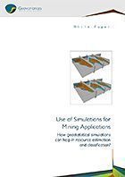
Use of Simulations for Mining Applications
Linear interpolation techniques – such as kriging – are inappropriate for dealing with issues that require a full characterization of spatial distribution (for example, probability of exceeding a threshold, variability of a product per mining period, recoverable resources at various cut-offs, etc.).
Only conditional simulations reproduce the true variability of your orebody. They are flexible in their application to complex mining processes and uncertainty assessment.
Through Geovariances’ multiple experiences in developing a variety of simulation strategies in different environments: kimberlite pipes, turbiditic and carbonate reservoirs, porphyry copper, alteration and hyd,rothermal type deposits, learn how geostatistical simulations can help in resource estimation and classification.

Hydrogeological Facies Modeling
Stochastic Methods for geological modeling and links with fluid flow simulations
Whatever the application domain – oil & gas production, aquifer pollution characterization, uranium production by lixiviation – characterizing the geological parameters and capturing their variability is essential to ensure realistic flow modeling…

Time to Depth Conversion
Time to depth conversion of geological surfaces is critical for structural model building. Quantifying the uncertainty attached to the conversion is also of primordial importance for assessing GRV uncertainties. Traditional velocity models used in time to depth conversion could benefit from geostatistical techniques used in data integration. The advantage of using geostatistical methods is that they fit the data in one step and allow quantifying the uncertainty attached to the prediction by mean of the generation of equiprobable realizations.
Through Geovariances long-lasting experience in geostatistical depth conversion studies, learn how geostatistics helps you improve the accuracy of your reservoir structural model and assess the uncertainties on surfaces.
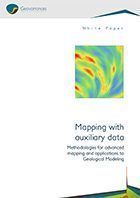
Mapping with auxiliary data
Through this white paper, discover how you canimprove significantly map reliability and quality by incorporating various sources of information in the interpolation process.
This document details the different methods for assimilating various sources of information, taking into account the reliability of each source and how the uncertainty associated with any mapping result can be estimated and reduced.
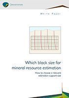
Which block size for mineral resource estimation
A key aspect of mineral resource estimation (MRE) is the definition of the block dimensions used to estimate the deposit attributes.
A satisfactory compromise is to be found to get an estimate that allows making decisions upon volumes that are representative of the physical reality of the operation while being aware that the density of information available at the time of estimation probably does not warrant the direct estimation of such volumes.
Through this white paper, learn how to choose a relevant support size for mineral resource estimation.
-
Enhancing environmental radionuclides tracking: High-resolution isotopic analysis using NanoSIMS | Presented at Goldschmidt Pragues 2025 - Louise Darricau (IRSN)
-
Application de la géostatistique dans l’analyse de risque géotechnique lié à la liquéfaction du sol (vidéo) | Gestion des Données et Nouvel Environnement numérique en Géotechnique - Journée technique CFMS 15 nov 2022
-
Amélioration de l’estimation des teneurs en alumine d’un gisement de kaolin à l’aide des simulations par bandes tournantes | XVe Journées de géostatistique 2021 - V. Bouchet (Imerys), M.C. Febvey (Geovariances), Hélène Binet (Geovariances), Armand Dubus (Geovariances)
-
Utilisation d’un algorithme de classification par Machine Learning pour la caractérisation géomécanique des sols | CFMS 2020 - par Marie-Cecile Febvey
-
Co-kriging of log ratios: a worked alternative method | Clint Ward, Cliffs, Ute Mueller ECU
-
Applicability of predicted cone penetration test profiles from geostatistical co-simulation on deterministic and probabilistic monopile foundation design for offshore wind turbines | Authors: L. Siemann (IWES), S. Wilhelm (GuD Consult), P. Masoudi (Geovariances), R. Relanez (IWES), P. Arnold (GuD Consult), B. Schwarz (IWES), F. Rackwitz (Technical University of Berlin), T. Mörz (University of Bremen) - Published in Ocean Engineering, Volume 355, Part 2, 2026
-
Stratigraphic and Geotechnical Modelling by Geostatistics, Applied to Penetrometer and Menard Pressure-Meter Tests | Masoudi, P., Simon, C., Faucheux, C. et al. - Mathematical Geosciences (2025). https://doi.org/10.1007/s11004-025-10242-0
-
Stochastic time-depth conversion of seismic horizons by geostatistical tools to produce probabilistic models of gross rock | Authors: P. Gibb (Petrosys | Interica), P. Masoudi (Geovariances), R. Mooney (Petrosys | Interic) - Presented at AAPG EAGE MEDINA Conference - Sept. 2025
-
Assessing paleo-channel distribution for probabilistic offshore windfarm ground modelling using Multiple-Point Statistics | Lennart Siemann, Ramiro Relanez - Fraunhofer Institute for Wind Energy Systems IWES - Presented at EAGE Annual 2025, Toulouse
-
Assessing paleo channel probability for offshore wind farm ground modeling – comparison of multiple-point statistics and sequential indicator simulation | Lennart Siemann, Ramiro Relanez - Fraunhofer Institute for Wind Energy Systems IWES - Published in Applied Computing and Geosciences 27 (2025) 100280