The latest version 2022.08 of Isatis.neo features a new powerful and one-of-a-kind flattening tool allowing unfolding the most complex geological structures for the most accurate variography and a new graphical tool to extract cross-sections and fences from 3D block models. It also offers numerous improvements that optimize its use.
[All the new features are available in the three editions of Isatis.neo, Standard, Mining, and Petroleum.]
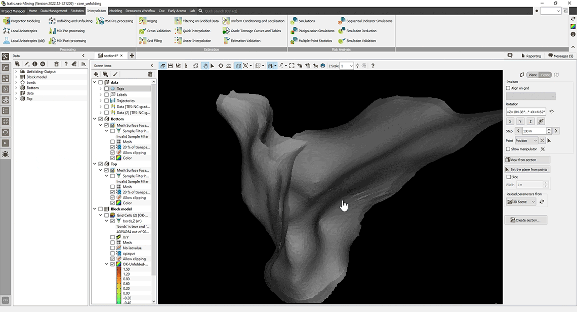
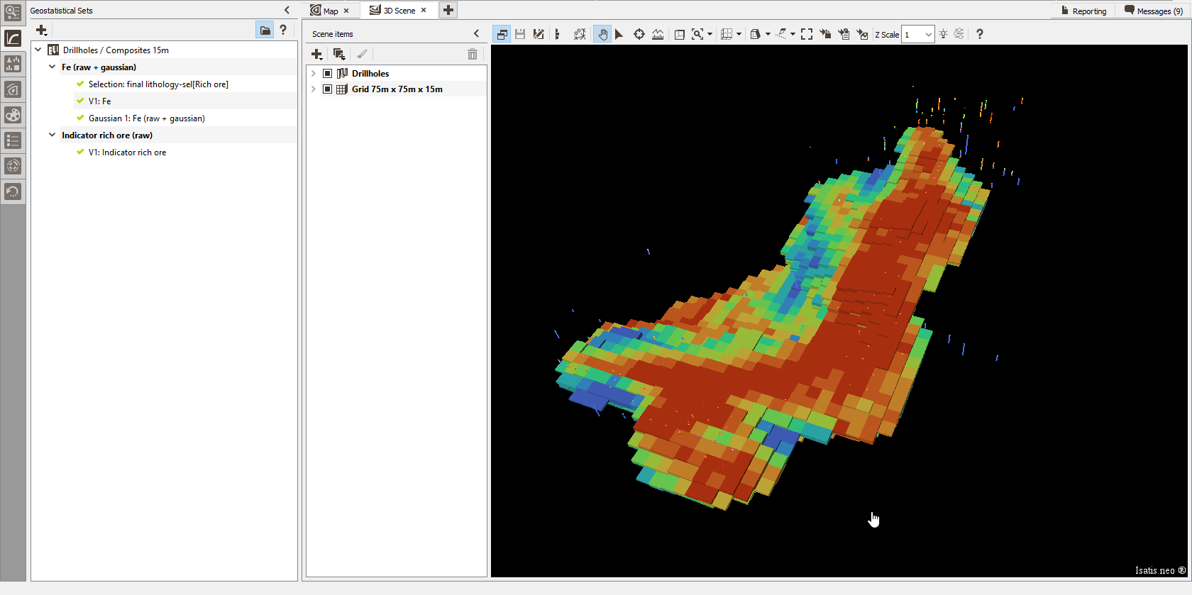
Unfolding
Flatten complex geological folded structures using the new Bend option from the Unfolding application. This option applies a new exclusive algorithm based on the Landmark Multi-Dimensional Scaling method (LMDS from Silva & Tenenbaum). It is particularly recommended when dealing with highly bended surfaces.
It uses two reference surfaces (bottom and top) that are flattened using multidimensional scaling, and the folded objects (e.g., drill holes) are mapped to the flattened space.
You achieve the variographic analysis and estimation in the flattened space and then transfer estimates to the real world.
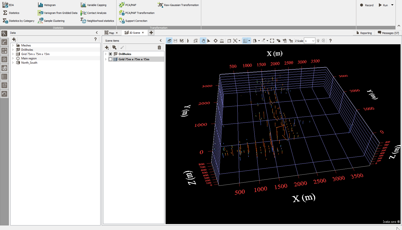
Cross-sections and fence sections
Generate 2D fence sections from your 3D model defining a polyline on a projected view by drawing it interactively, selecting key points in the map, or entering their coordinates. Objects included in a band around the path will be projected into the section.
Graphic superimposition
Merge several graphics into a unique display. You can do it by selecting the chart files you wish to merge, and defining the axis bounds of the new graphics.
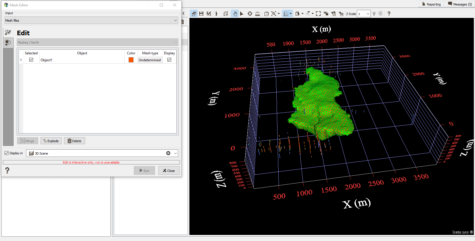
Mesh editor
Edit the name and the color of each mesh. Check the selected mesh type, closed, open, or undetermined. Merge or separate objects from a mesh. Combine several meshes in one mesh.
Geostatistical set import and export
Easily exchange geostatistical sets between projects through the import/export of files available from the Geoset explorer. All the related information, e.g., reference on data, associated statistics, anamorphosis, experimental variogram, model, etc., will be copied from one project to another.
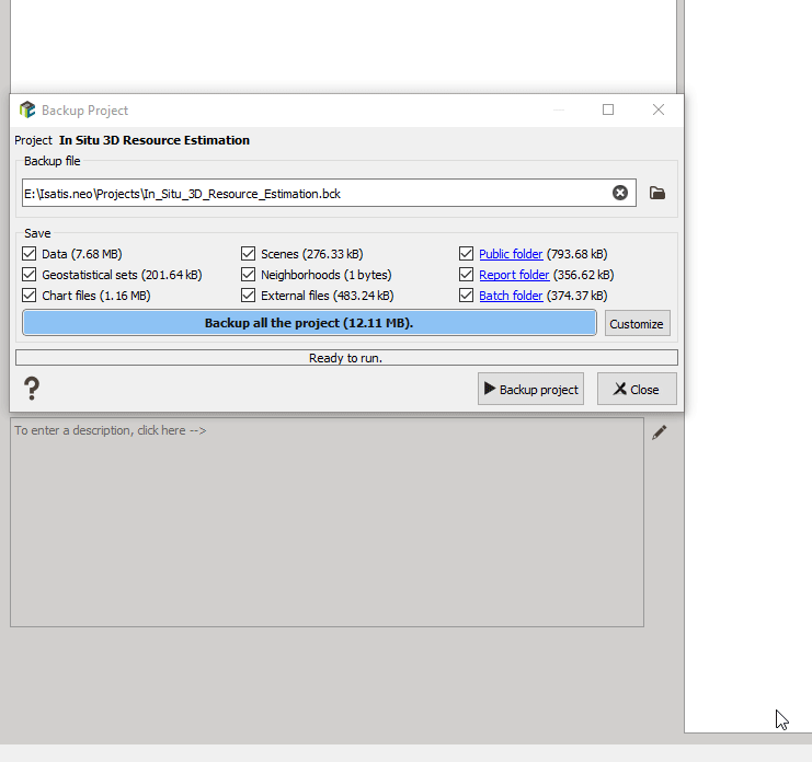
Custom backup
Select what you want to keep in your backup files, data, geostatistical sets, chart files, scenes, neighborhoods, external files, public folder content, report content, or batch files. You can select by choosing the type of data to save globally or, more finely, selecting the files or objects to save.
More improvements
- Use categorical variables to define selections.
- Handle sub-vertical surfaces when calculating local anisotropies.
- Be informed on the stability of a multivariate variogram model through a green/red light. A click on a button automatically applies a correction to the sill matrices to make the model stable.
- Define neighborhoods using anisotropic distances. Anisotropic distances are calculated between [0; 1], where 0 is the target location, and 1 is the extension of the ellipsoid.
Early-access menu
The Early Access menu gives you access to functionalities, the interfaces of which are not optimized. It offers advanced users the opportunity to test them and give their feedback to orientate the latest developments.
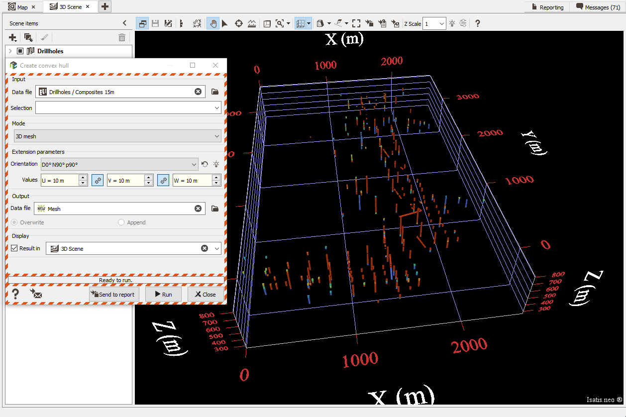
Convex hull
Define the area of interest of your project by generating a convex envelope surrounding your data with a mouse click. It can be a 2D or a 3D polygon or a mesh. This envelope defines the area used to constrain the interpolation in space.