Enrich your maps with background images: discover a list of websites from where you can download spatial data for free
Posted on There is no better way to understand your data than to display it in its global environmental context. Geovariances software solutions, Isatis.neo and Kartotrak, embed GIS components for the 2D display of data of any kind (points, borehole tops, grids, polylines, polygons) in several layers. It is then easy to enrich your maps by adding background images imported from geographic raster or vector files.
Isatis.neo (our comprehensive solution in geostatistics) and Kartotrak (our solution dedicated to contaminated site characterization) can read many file formats including standard image file formats (bmp, gif, jpg, png, tif), CAD DWG/DXF, GeoTIFF, MapInfo, or ESRI Shapefile.
But sometimes, even in our virtual world, information might still be provided on a good old paper map. It’s not an issue. You can import it scanned into Isatis.neo or Kartotrak as an image file, then geolocalize it in a few clicks by translating, rotating, and applying homotheties to the loaded image to superimpose it accurately to the map.
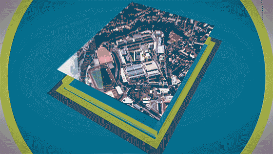
Similarly, aerial views can be georeferenced, allowing you to go back in time and better understand your site context (e.g., buried pipes, removed buildings, former storage zones). It is then like playing the spot-the-differences game!
Here is a first list of websites where you can find worldwide spatial data to improve your large scale maps:
– Vector files by country (administrative boundaries, rivers, roads, rail, elevation, occupation, population): www.diva-gis.org/data
– Files at different resolutions (country, city, raster…): www.naturalearthdata.com
– Topographic files (x,y,z or raster) 1 minute resolution: www.ncei.noaa.gov/maps/grid-extract
– Space and airborne images: earthexplorer.usgs.gov
– OpenStreetMap: extract.bbbike.org
And below are more detailed and national background map providers:
– For our Swiss friends: www.geo.admin.ch
– La même chose en France: www.geoportail.gouv.fr, remonterletemps.ign.fr
– Para España, ya está aquí: centrodedescargas.cnig.es/CentroDescargas
If you also know sites that provide spatial data, we invite you to give the info to Ophélie Lemarchand. She will be happy to share it with our users’ community. Thanks 🙂
Mining (14)
Nuclear Decommissioning (9)
Contaminated sites (7)
Oil & Gas (6)
Hydrogeology (5)
TAGS:
2D/3D (2)
Background images (1)
Big data (1)
Conditional simulations (7)
Contaminated sites (2)
Contamination (2)
Drill Hole Spacing Analysis DHSA (3)
Excavation (2)
Facies modeling (2)
Flow modeling (1)
Geological modeling (3)
Gestion des sites pollués (2)
H2020 INSIDER (1)
Horizon mapping (1)
Ice content evaluation (1)
Isatis (11)
Isatis.neo (16)
Kartotrak (8)
Machine Learning (2)
Mapping (3)
MIK (2)
Mineral resource estimation (7)
Monitoring network optimization (1)
MPS (2)
Ore Control (1)
Pareto (2)
Pollution (2)
Post-accidental situation (2)
Recoverable resource estimation (3)
Resource classification (2)
Resources workflow (1)
Resource workflow (3)
Risk analysis (3)
Sample clustering (1)
Sampling optimization (3)
Scripting procedures (3)
Simulation post-processing (1)
Site characterization (2)
Soil contamination mapping (4)
Time-to-Depth conversion (1)
Uncertainty analysis (2)
Uniform Conditioning (5)
Variography (2)
Volumes (2)
Water quality modeling (1)
AUTHORS:
David Barry (3)
Yvon Desnoyers (2)
Pedram Masoudi (2)
Catherine BLEINES (1)
Pedro Correia (1)
DATES:
2023 (2)
2022 (3)
2021 (2)
2020 (2)
2019 (8)
2018 (4)
2017 (3)
2016 (3)