Industry: Hydrogeology
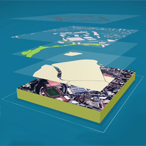
Enrich your maps with background images: discover a list of websites from where you can download spatial data for free
Posted on
There is no better way to understand your data than to display it in its global environmental context. Geovariances software solutions, Isatis.neo and Kartotrak, embed GIS components for the 2D display of data of any kind (points, borehole tops, grids, polylines, polygons) in several layers. It is then easy to enrich your maps by adding background images imported from geographic raster or vector files.
Things I’ve done with Python in Isatis.neo
Posted on
Discover what our senior geostatistician David Barry does in Isatis.neo with the power of Python scripting.
Isatis for geological modeling and hydrogeology
Posted on
Isatis assists in characterizing aquifers and building accurate numerical models of the subsurface by generating reliable maps of geological layers, petrophysical properties, mechanical or hydrogeological properties and facies data.
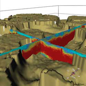
Compute flow path lines with Isatis
Posted on
Isatis offers a Streamlines Calculator that allows computing flow path lines according to a 2D surface.
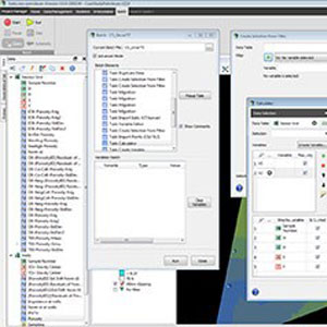
Boost your productivity with Isatis scripts
Posted on
Everyone who uses Isatis scripting knows how powerful the tool is. It benefits our principal environmental consultant Claire Faucheux’s work every day. Discover why…
Mining (14)
Nuclear Decommissioning (9)
Contaminated sites (7)
Oil & Gas (6)
Hydrogeology (5)
TAGS:
2D/3D (2)
Background images (1)
Big data (1)
Conditional simulations (7)
Contaminated sites (2)
Contamination (2)
Drill Hole Spacing Analysis DHSA (3)
Excavation (2)
Facies modeling (2)
Flow modeling (1)
Geological modeling (3)
Gestion des sites pollués (2)
H2020 INSIDER (1)
Horizon mapping (1)
Ice content evaluation (1)
Isatis (11)
Isatis.neo (16)
Kartotrak (8)
Machine Learning (2)
Mapping (3)
MIK (2)
Mineral resource estimation (7)
Monitoring network optimization (1)
MPS (2)
Ore Control (1)
Pareto (2)
Pollution (2)
Post-accidental situation (2)
Recoverable resource estimation (3)
Resource classification (2)
Resources workflow (1)
Resource workflow (3)
Risk analysis (3)
Sample clustering (1)
Sampling optimization (3)
Scripting procedures (3)
Simulation post-processing (1)
Site characterization (2)
Soil contamination mapping (4)
Time-to-Depth conversion (1)
Uncertainty analysis (2)
Uniform Conditioning (5)
Variography (2)
Volumes (2)
Water quality modeling (1)
AUTHORS:
David Barry (3)
Pedram Masoudi (2)
Yvon Desnoyers (2)
Catherine BLEINES (1)
Pedro Correia (1)
DATES:
2023 (2)
2022 (3)
2021 (2)
2020 (2)
2019 (8)
2018 (4)
2017 (3)
2016 (3)