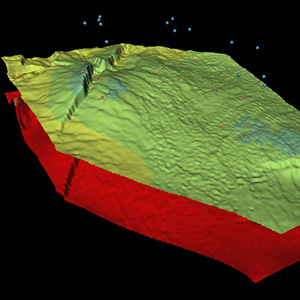
Uncertainty in Depth Conversion: Why should I care?
Posted on
Conversions & Uncertainties Workflow, Geovariances’ new tool for depth conversion, gives the user the means to explore all credible reservoir scenarios. It helps prove or disprove the meaningfully different scenarios obtained from a set of realizations and increase the accuracy of your reservoir model.
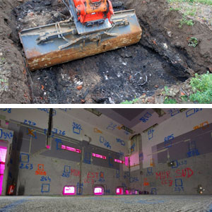
Geostatistics is recommended in international guidelines for contaminated site management
Posted on
Benefit from the recognized status of the geostatistics methods. Embrace the official recommendations to earn the trust of your clients.
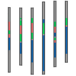
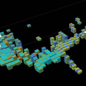
Sample clustering in Isatis.neo has proven to be efficient with big datasets
Posted on
Isatis.neo quickly groups borehole samples into homogeneous classes (e.g., facies, geological or mining domains) in an automatic way. Those who have seen the tool run qualifies it as impressive.
The importance of being … consistent
Posted on
The search for productivity improvements is pervasive in the mining industry and MRE software are no strangers to the quest for speed seen in all operational processes. But that quest, whilst valid and sound, should not come at the price of quality, optimality or consistency in the manner information is treated.
Can you afford to bypass geostatistics for the sake of productivity?
Posted on
Anyone involved with today’s mining industry understands that the sector is facing very tough challenges. And it is under enormous pressure from due cost control and budgetary management constraints that innovation and ingenuity must still find their way to propose new ways of tackling traditional issues. Mineral Resource Estimation (MRE) is no stranger to that conundrum and their practitioners all know the multi facets of the game: integrate more and more data, boost productivity, and come up with an answer fast and at the same time enriched with an assessment of the uncertainty that can be attached to that answer. All of that in a fraction of the time they used to have at their disposal and less resources to double check…
Mining (14)
Nuclear Decommissioning (9)
Contaminated sites (7)
Oil & Gas (6)
Hydrogeology (5)
TAGS:
2D/3D (2)
Background images (1)
Big data (1)
Conditional simulations (7)
Contaminated sites (2)
Contamination (2)
Drill Hole Spacing Analysis DHSA (3)
Excavation (2)
Facies modeling (2)
Flow modeling (1)
Geological modeling (3)
Gestion des sites pollués (2)
H2020 INSIDER (1)
Horizon mapping (1)
Ice content evaluation (1)
Isatis (11)
Isatis.neo (16)
Kartotrak (8)
Machine Learning (2)
Mapping (3)
MIK (2)
Mineral resource estimation (7)
Monitoring network optimization (1)
MPS (2)
Ore Control (1)
Pareto (2)
Pollution (2)
Post-accidental situation (2)
Recoverable resource estimation (3)
Resource classification (2)
Resources workflow (1)
Resource workflow (3)
Risk analysis (3)
Sample clustering (1)
Sampling optimization (3)
Scripting procedures (3)
Simulation post-processing (1)
Site characterization (2)
Soil contamination mapping (4)
Time-to-Depth conversion (1)
Uncertainty analysis (2)
Uniform Conditioning (5)
Variography (2)
Volumes (2)
Water quality modeling (1)
AUTHORS:
David Barry (3)
Yvon Desnoyers (2)
Pedram Masoudi (2)
Pedro Correia (1)
Catherine BLEINES (1)
DATES:
2023 (2)
2022 (3)
2021 (2)
2020 (2)
2019 (8)
2018 (4)
2017 (3)
2016 (3)