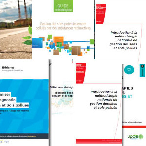
La géostatistique est recommandée par les guides méthodologiques sur la gestion des sites et sols pollués
Posted on
Suivez les recommandations officielles et bénéficiez du statut reconnu des méthodes géostatistiques pour gagner la confiance de vos clients.
Isatis for geological modeling and hydrogeology
Posted on
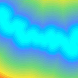
Isatis assists in characterizing aquifers and building accurate numerical models of the subsurface by generating reliable maps of geological layers, petrophysical properties, mechanical or hydrogeological properties and facies data.
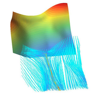
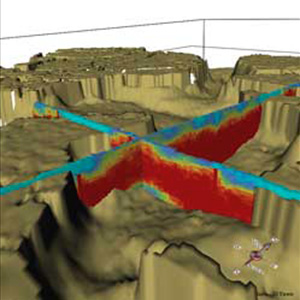
Compute flow path lines with Isatis
Posted on
Isatis offers a Streamlines Calculator that allows computing flow path lines according to a 2D surface.
Use genetic models to constrain facies models and ensure accuracy and realism
Posted on
Geological modeling in Isatis can be achieved using MPS methodology or Flumy, our applications for meandering system modeling. Do you know that you can combine both of them to ensure model accuracy and realism? See the tests done for a NOC.
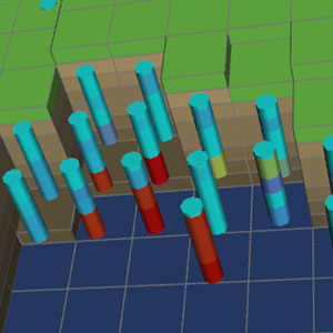
How confident are you with your management plan quality?
Posted on
The Kartotrak Excavation task allows generating excavation plans easily and fastly from 3D interpolated contamination maps. And it is only available in Kartotrak!
Mining (14)
Nuclear Decommissioning (9)
Contaminated sites (7)
Oil & Gas (6)
Hydrogeology (5)
TAGS:
2D/3D (2)
Background images (1)
Big data (1)
Conditional simulations (7)
Contaminated sites (2)
Contamination (2)
Drill Hole Spacing Analysis DHSA (3)
Excavation (2)
Facies modeling (2)
Flow modeling (1)
Geological modeling (3)
Gestion des sites pollués (2)
H2020 INSIDER (1)
Horizon mapping (1)
Ice content evaluation (1)
Isatis (11)
Isatis.neo (16)
Kartotrak (8)
Machine Learning (2)
Mapping (3)
MIK (2)
Mineral resource estimation (7)
Monitoring network optimization (1)
MPS (2)
Ore Control (1)
Pareto (2)
Pollution (2)
Post-accidental situation (2)
Recoverable resource estimation (3)
Resource classification (2)
Resources workflow (1)
Resource workflow (3)
Risk analysis (3)
Sample clustering (1)
Sampling optimization (3)
Scripting procedures (3)
Simulation post-processing (1)
Site characterization (2)
Soil contamination mapping (4)
Time-to-Depth conversion (1)
Uncertainty analysis (2)
Uniform Conditioning (5)
Variography (2)
Volumes (2)
Water quality modeling (1)
AUTHORS:
David Barry (3)
Yvon Desnoyers (2)
Pedram Masoudi (2)
Pedro Correia (1)
Catherine BLEINES (1)
DATES:
2023 (2)
2022 (3)
2021 (2)
2020 (2)
2019 (8)
2018 (4)
2017 (3)
2016 (3)